

Atlas · land-survey context
Land Survey Atlas
PLSS sections and quarter-quarter cells are survey geometry. A highlighted section has a held historic GLO patent location; that does not identify its current owner, title, tax status, or boundaries.
The four detail frames are reading windows, not administrative quarters. For historic land records, treat this atlas as a locator and follow the linked records.
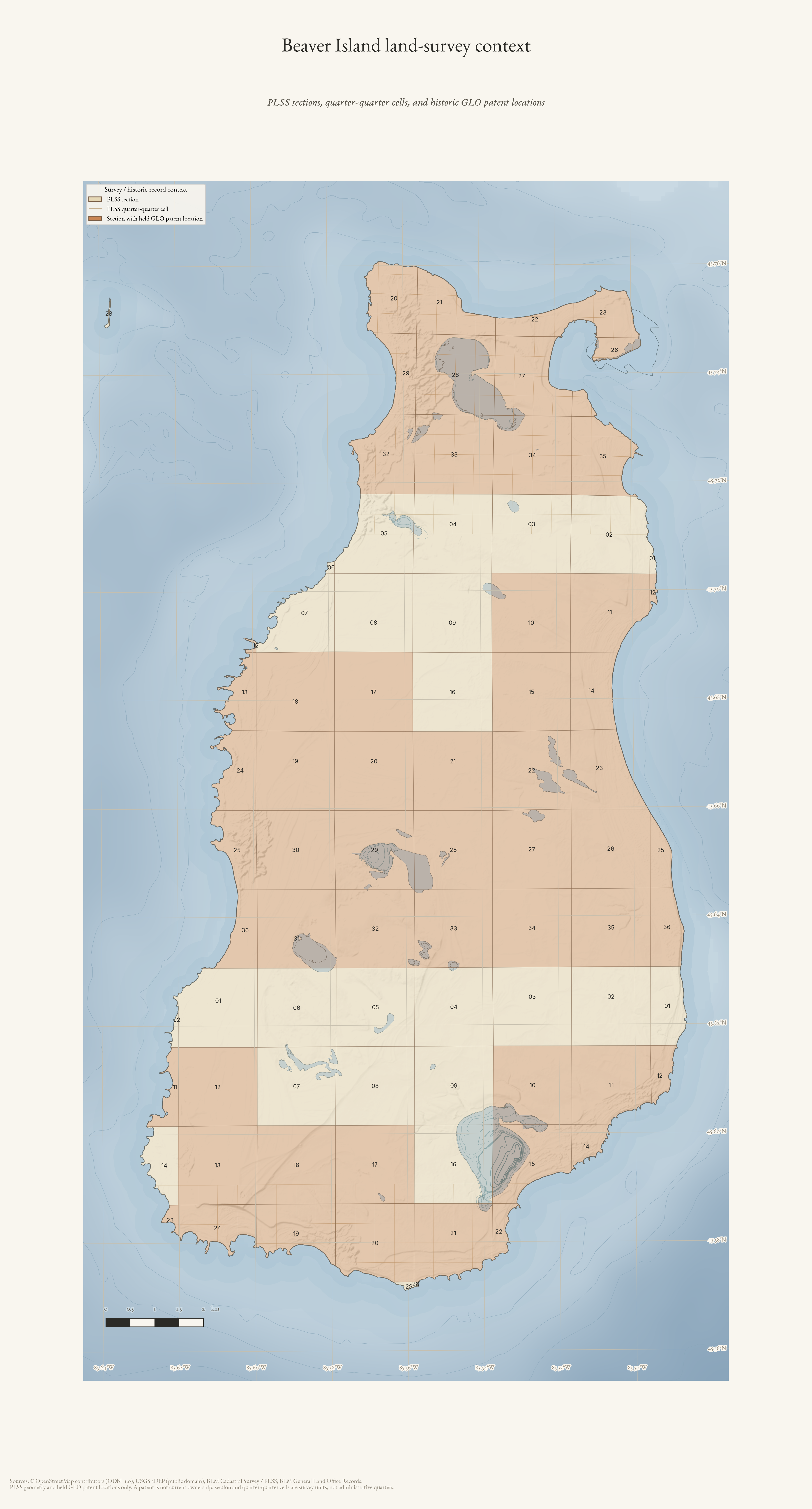
Beaver Island land-survey context
PLSS sections and quarter-quarter survey cells with sections containing held historic GLO patent locations—not current ownership.
Drawn from the archive's own data in EPSG:3078. Map data © OpenStreetMap contributors (ODbL 1.0); BLM Cadastral Survey / PLSS and BLM General Land Office Records; Michigan Geographic Framework PLSS; USGS 3DEP (public domain).
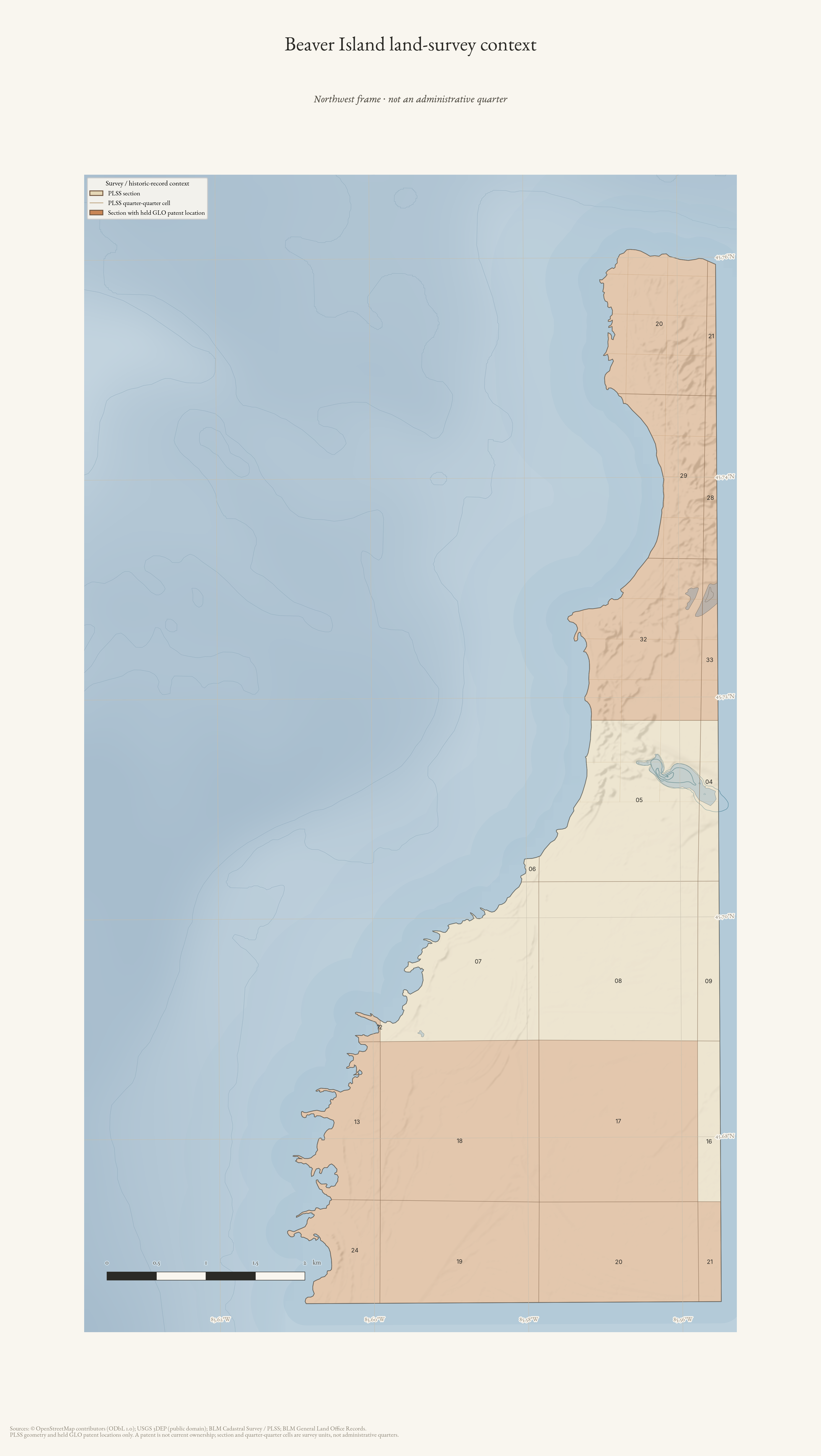
Beaver Island land-survey detail — Northwest
Northwest frame of PLSS survey cells and historic patent-location context; not an administrative quarter or current ownership map.
Drawn from the archive's own data in EPSG:3078. Map data © OpenStreetMap contributors (ODbL 1.0); BLM Cadastral Survey / PLSS and BLM General Land Office Records; Michigan Geographic Framework PLSS; USGS 3DEP (public domain).
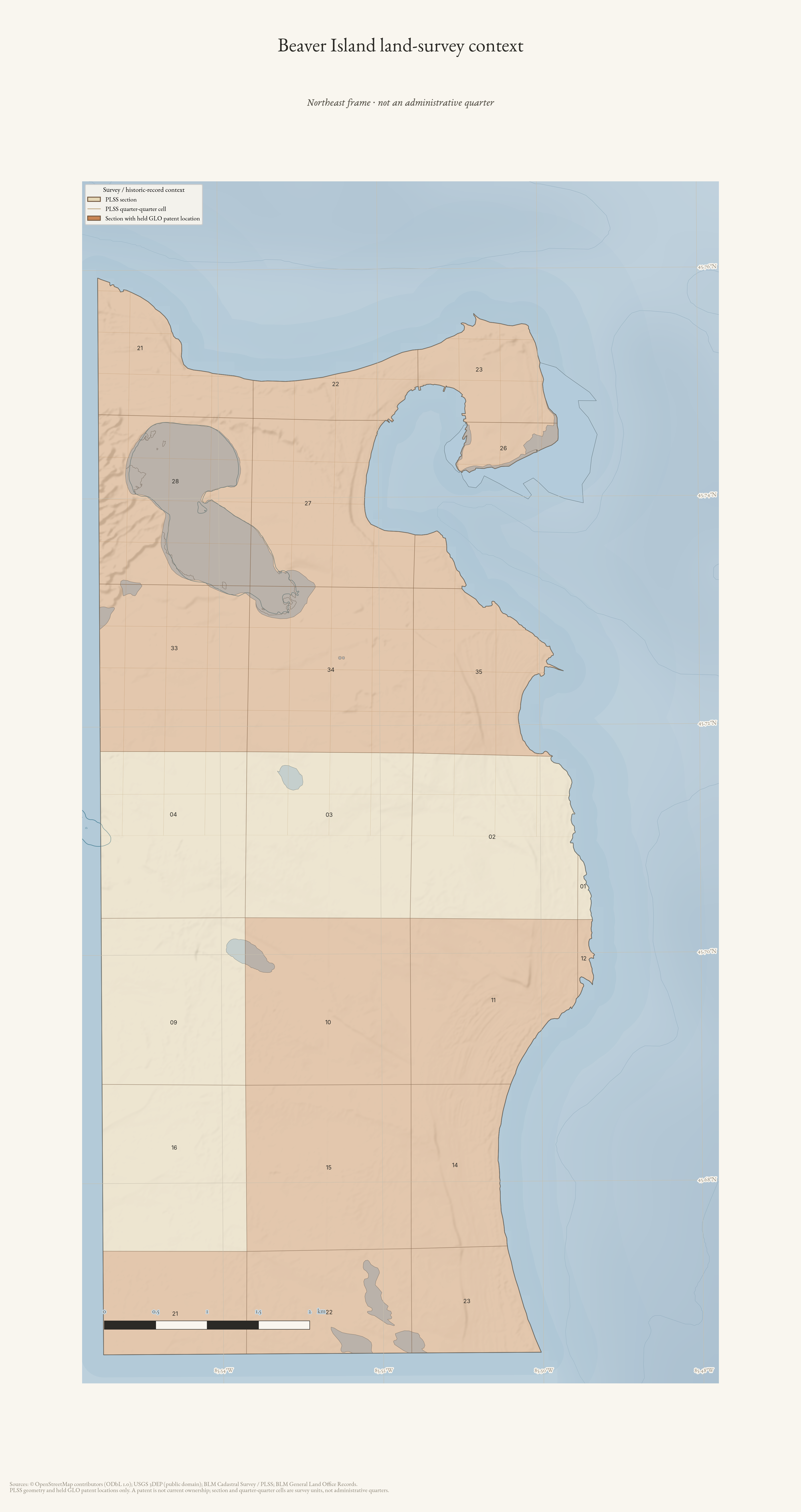
Beaver Island land-survey detail — Northeast
Northeast frame of PLSS survey cells and historic patent-location context; not an administrative quarter or current ownership map.
Drawn from the archive's own data in EPSG:3078. Map data © OpenStreetMap contributors (ODbL 1.0); BLM Cadastral Survey / PLSS and BLM General Land Office Records; Michigan Geographic Framework PLSS; USGS 3DEP (public domain).
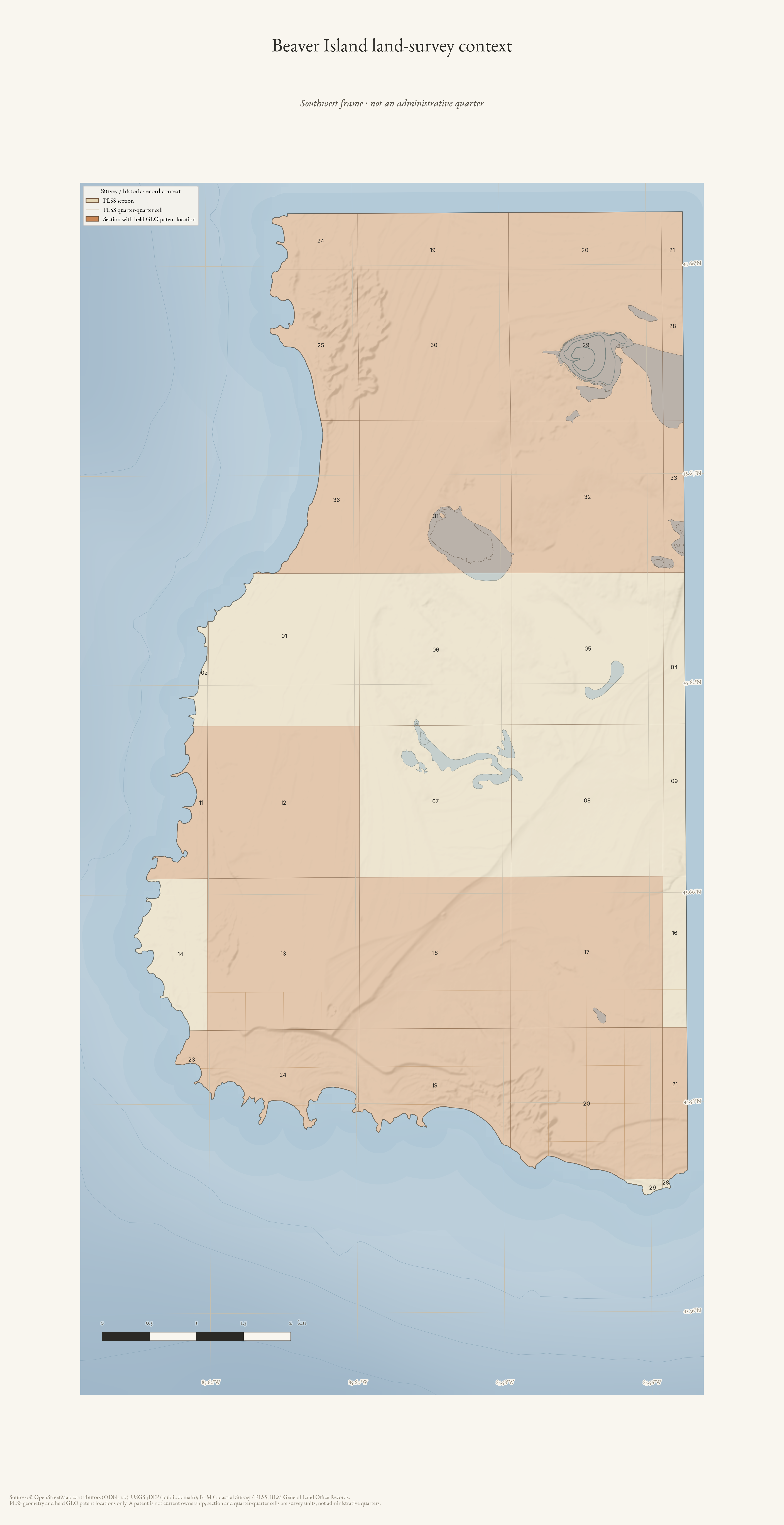
Beaver Island land-survey detail — Southwest
Southwest frame of PLSS survey cells and historic patent-location context; not an administrative quarter or current ownership map.
Drawn from the archive's own data in EPSG:3078. Map data © OpenStreetMap contributors (ODbL 1.0); BLM Cadastral Survey / PLSS and BLM General Land Office Records; Michigan Geographic Framework PLSS; USGS 3DEP (public domain).
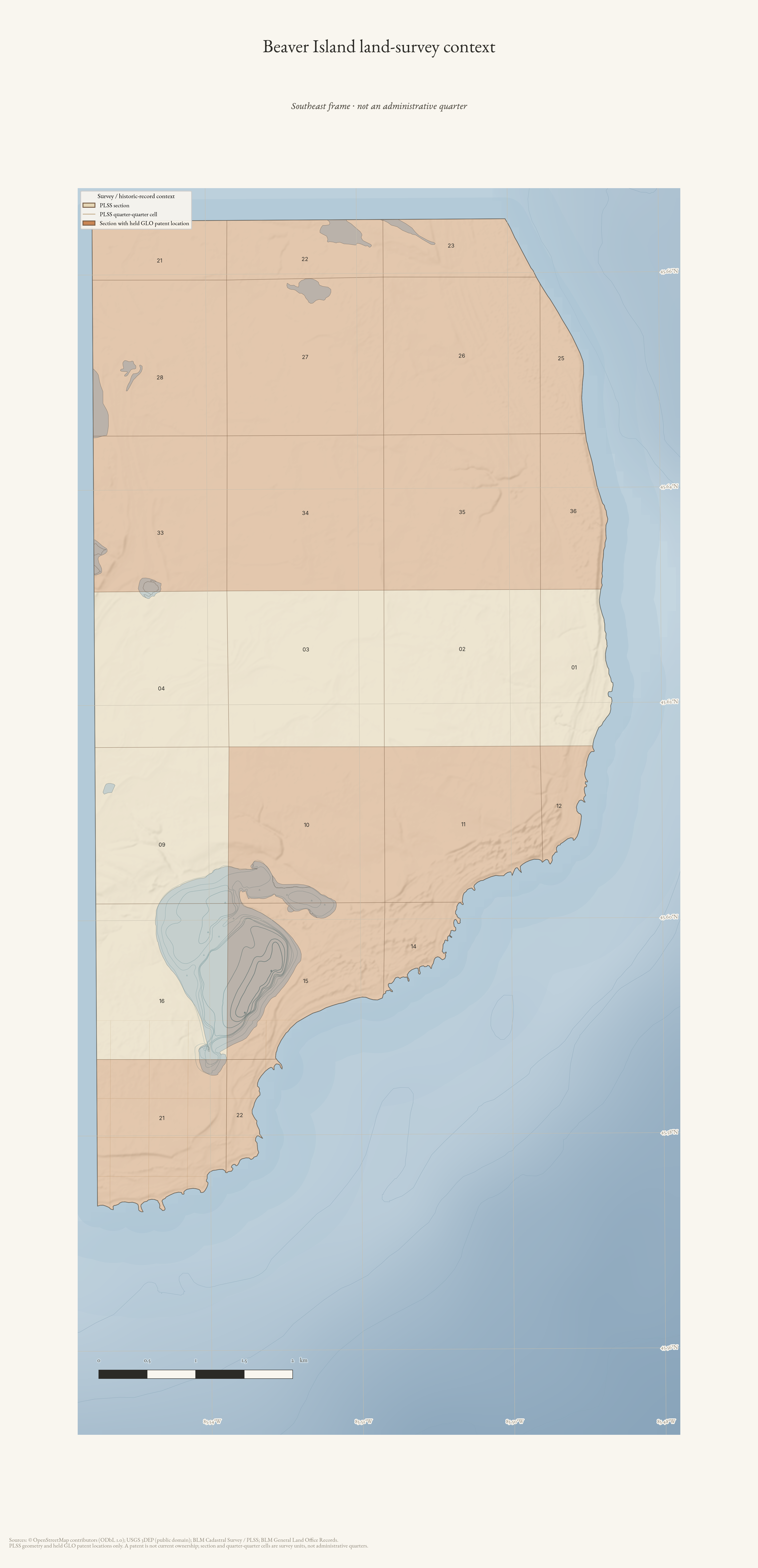
Beaver Island land-survey detail — Southeast
Southeast frame of PLSS survey cells and historic patent-location context; not an administrative quarter or current ownership map.
Drawn from the archive's own data in EPSG:3078. Map data © OpenStreetMap contributors (ODbL 1.0); BLM Cadastral Survey / PLSS and BLM General Land Office Records; Michigan Geographic Framework PLSS; USGS 3DEP (public domain).