

Trails
Beaver Island has somewhere between twenty-four and thirty-five named trails. The count depends on which document you read, and the archive cannot make the lists agree.
There is a reason for that. Someone prints a route on a map. Someone else walks it. Someone else cuts the fallen trees out of it. They are rarely the same person, and rarely in the same year. This page lists every named route the archive holds, and says what kind of evidence puts each one on the map.
29 routes · 17 mapped · 7 rough line · 5 with no map line held
The four kinds of evidence
- Printed
- A township or a trail group printed a sheet for it. The archive holds nineteen of these.
- Mapped
- A line exists in OpenStreetMap. It carries 139 ways under 32 names.
- Walked
- Someone walked it with a GPS at walking pace. Five tracks, from 2024 and 2025, all at the south end.
- Searched
- Someone walked slowly and found no path. Kept, so the same ground is not searched twice.
These four often disagree. A township sheet prints the Blue Trail, and OpenStreetMap has no line for it at all. Twelve walked runs, 6.55 km together, are on the ground and not on the map. A lidar survey was meant to find old trails from the shape of the bare earth. It found five of those twelve. So when the ground looks empty in the relief, that is not proof that nothing is there.
The maps
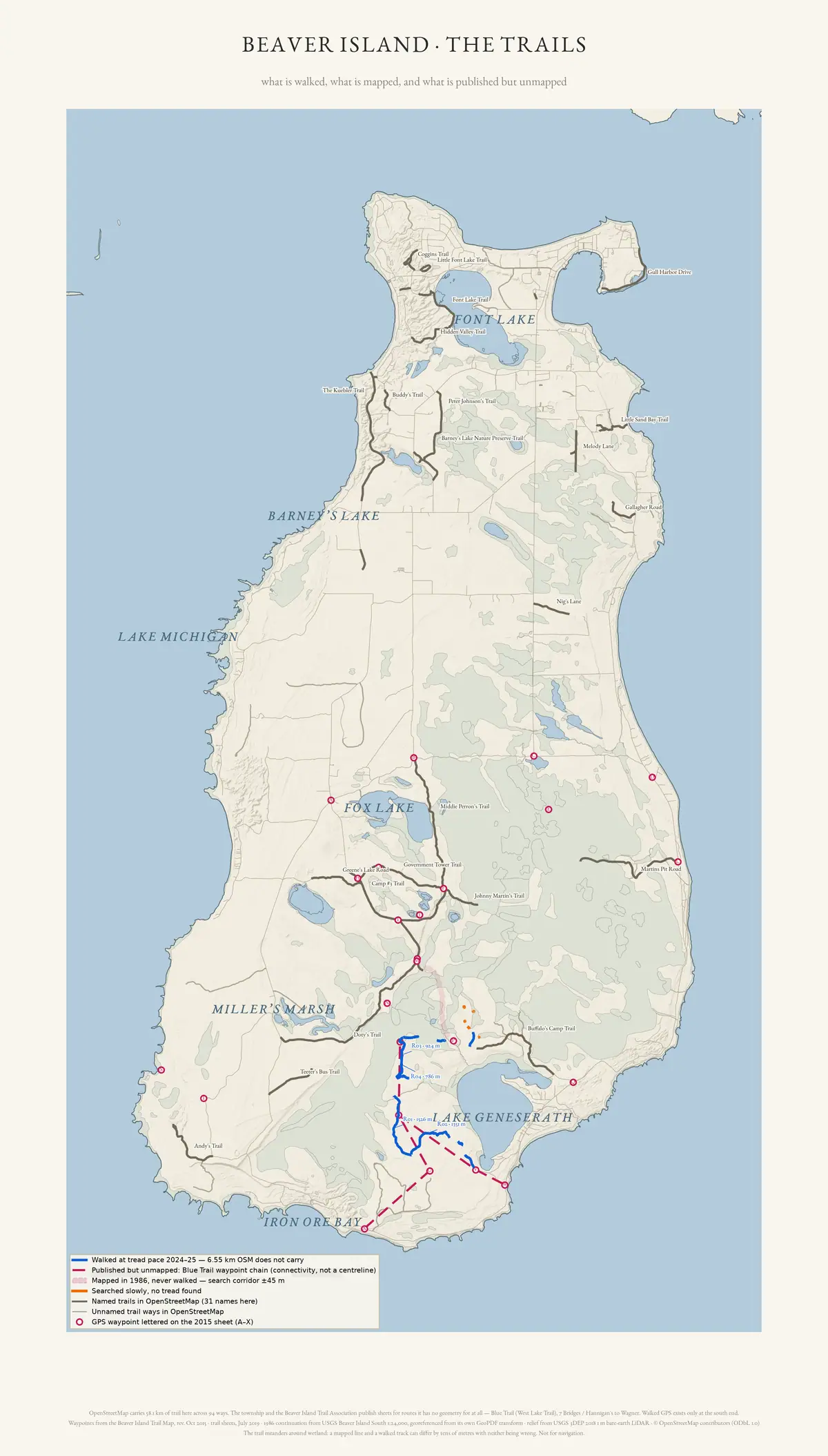 The whole island
Each kind of evidence gets its own mark, over a lidar image of the bare ground.
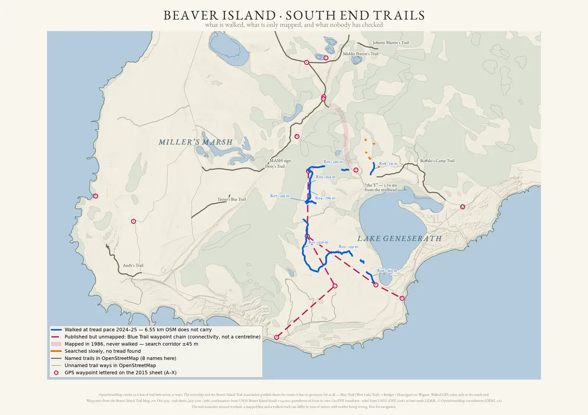 The south end
Where the walked tracks are. It also shows five runs where someone looked and found no path.
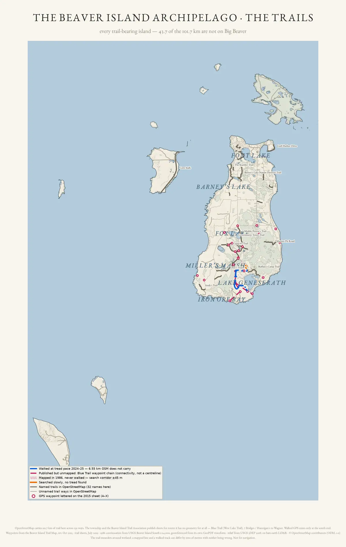 The whole archipelago
Every island in the group that has a trail. Forty-five of the 139 mapped ways are not on Big Beaver.
The named routes
North end and the harbour
Port St. James, Donegal Bay, and the Font Lake basin.
- Kuebler Trailrough line
- Hidden Valley Trailmapped
- Little Font Lake Trailmapped
- Little Sand Bay Trailmapped
- Mooney's Trailno map line
- Fox Pointe Trailmapped
- Coggins Trailmapped
West side and the dunes
The shore trails, and the ways down to the dunes.
- Mrs Redding Trailmapped
- Andy's Trailmapped
- Katherine's Climb Trailmapped
- Young James Trailmapped
South end, Lake Geneserath, and the Beaver Head
The inland network. This is the only ground anyone has walked with a GPS for the archive.
- Blue Trailrough line
- West Lake Trailrough line
- Buffalo’s Camp Trailmapped
- Doty’s Camp Trailrough line
- North Lake Trailmapped
- Camp #3 Trailmapped
- Greene’s Lake Trailrough line
- Johnny Martin’s Trailmapped
- Middie Perron’s Trailmapped
- 7 Bridges Trailrough line
- Government Tower Trailmapped
- Buddy's Trailmapped
- Betsy Smith Trailmapped
The outer islands
Reached only by boat. Cleared under yearly permits from the state.
- Danes Trailno map line
Not yet sorted by area
The article for each of these says where it runs.
- Cable's Creek Trailno map line
- French Bay Trailno map line
- Trail Road (historic)no map line
- The unnamed trail west of Lake Geneserathrough line
Before you walk any of it
Most of these are not built trails. They are old county roads, or logging two-tracks the state cut years ago. That is the trail association's own description of them, not ours.
One route can cross state land, a county road, township property, a nature preserve, and private land. Permission written down in one year is not permission this year. Each article says what its sources show about who owns the ground. Where they show nothing, it says that too.
Not for navigation. The trail association prints the warning on its own maps: island trails “can become overgrown and unrecognizable in many areas.”
Something here wrong or missing?Tell us.