

- Coordinates
- 45.6360° N, 85.5498° WGoogle Maps: Government Tower TrailDownload KML
- Eras
- Modern era
- Concepts
- trailsrecreationModern eratoponymytransportation
- Within
- Beaver Island
Summary
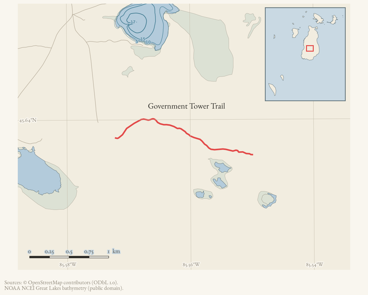
Government Tower Trail is a 1.25-mile connector in the interior of Beaver Island, joining Middie Perron’s Trail to Camp #3 Trail. It is named for a state fire lookout tower that once stood on it and no longer does.
The route
Published in the township trail guide and mapped in OpenStreetMap under this name; no walked track is held.
The trail leaves Middie Perron’s Trail about 1.73 miles south of that trail’s start at the Fox Lake Road and Hannigan’s Road intersection, and runs west to meet Camp #3 Trail. The guide is blunt about its condition: it “is never truly passable for normal motor vehicles, with half a dozen deep holes usually full of water and soft mud as well”, while remaining “always bikeable and hikeable”.
The trail association’s cue sheets treat it not as a destination but as a leg of a longer circuit, combining Middie Perron’s Trail, the Government Tower section, Camp Three Trail and Fox Lake Road into a loop of about 5.3 miles.
What the route was
The guide records that “the former fire tower lookout was on this road”. The tower is the trail’s namesake and is gone; the archive holds no photograph of it, no construction or removal date, and no state record of its operation.
Access and ownership
The trail lies in the island’s interior among state land and forest roads. The archive holds no easement, ownership or permission record specific to this route, and its public status should not be assumed from its appearance in a township guide. Under Public Act 288 of 2016 state forest roads are open to off-road vehicles unless posted closed; that provision concerns forest roads, not trails, and no ORV designation for this trail is recorded.
Evidence and limits
One published description and one mapped geometry, with no walked track, no photograph and no documentary record of the tower itself.
Open questions
- When was the fire lookout tower built, staffed and removed? No state record of it is held.
- Does a photograph of the tower survive in any island collection?
- Is the mapped OpenStreetMap route the same line the guide describes? Nothing in the archive has checked them against each other on the ground.
If you can answer any of these, or correct anything above, the archive wants to hear it — see Corrections.
See also
Documented associations
No source-confirmed non-road entity is linked yet. Exact-name research leads remain in scripts/audit_road_links.py; a name collision is not treated as a road association.
Research status
The local newspaper and website corpus contains exact-name mentions in 0 file(s). Those files are research leads; the relation layer is added only when the surrounding source text establishes that the record involves this road.
Maps for this place
These Atlas plates provide regional context. They do not establish a precise boundary, current ownership, access right, operating status, or field condition.
- EnvironmentSoils, wetlands, hydrography, and terrain
- GeologyGeneralized geology and landforms
- HydrologyMapped water and wetland context
- AccessMapped routes, facilities, and protected areas
- Land surveyPLSS geometry and historic GLO patent-location context
Sources
- Turn-by-turn narrative descriptions with cumulative mileages for the island's named trails. Undated in the file; retrieved from the township document centre in August 2026. No author is named in the document or its metadata.governance · peaine · trails · all-trail-descriptions
- Community-contributed geometry of unknown survey provenance, licensed ODbL 1.0. Not an authoritative trail inventory.osm · trails
Added 16 August 2026. Recent changes
Cite this article
Beaver Island Archive, “Government Tower Trail”, https://beaverislandarchive.org/places/government-tower-trail/, accessed [date], citing Peaine Township, 'All Trail Descriptions', trail guide, undated. (and 1 further source listed on the page).
BibTeX for “Government Tower Trail”RIS for “Government Tower Trail”