

- Eras
- Modern era
- Concepts
- trailscartographyrecreation
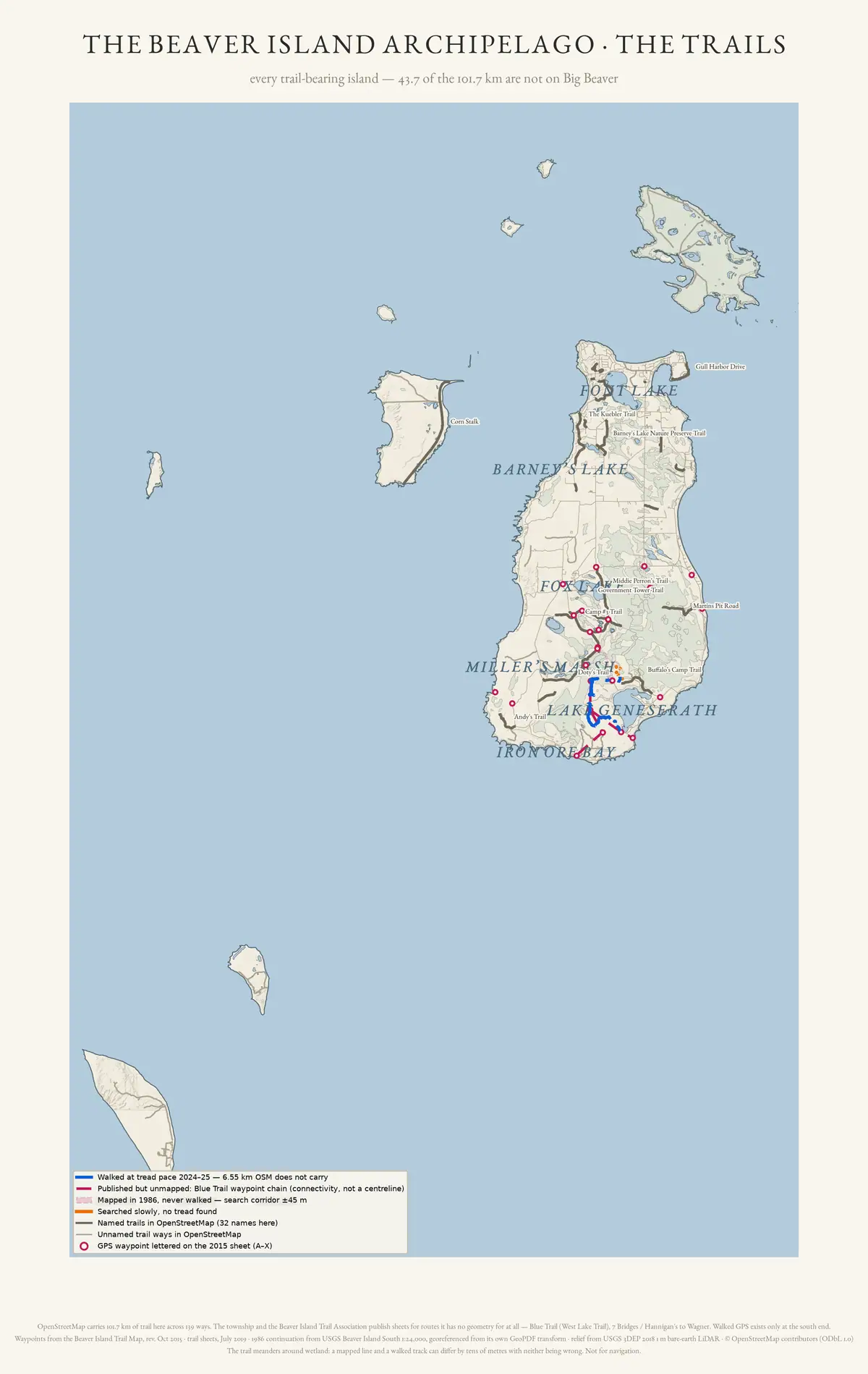
Every trail-bearing island in the group. Forty-five of the 139 mapped trail ways, and 43.7 of the 101.7 km, lie outside Big Beaver — including Corn Stalk, the longest named trail in the archipelago at 6.09 km.
Mapped geometry only. No walked track exists for any island other than Beaver, and the trails recorded in state management plans for Garden, North Fox and South Fox islands are not all drawn here.
Open questions
- Which trails named in the state management plans for Garden, North Fox and South Fox islands are missing from this map, and would extracting their geometry from those plans close the gap?
- No walked GPS track exists for any island besides Beaver — would a tread-pace survey of Corn Stalk, the longest named trail in the archipelago at 6.09 km, confirm that its mapped OpenStreetMap geometry matches the ground?
If you can answer any of these, or correct anything above, the archive wants to hear it — see Corrections.
Sources
- Archive-generated trail atlas plate.Drawn from the archive's own OpenStreetMap trail extract, the walked GPS tracks of 2024-25, the trail-review package, and USGS 3DEP 2018 1 m bare-earth lidar. Map data (c) OpenStreetMap contributors (ODbL 1.0); relief and the 1986 quadrangle continuation are public domain.scripts · make_trail_map
Added 16 August 2026. Recent changes
Cite this article
Beaver Island Archive, “Trails of the Beaver Island archipelago”, https://beaverislandarchive.org/map/atlas-beaver-archipelago-trails/, accessed [date], citing Archive-generated trail atlas plate..
BibTeX for “Trails of the Beaver Island archipelago”RIS for “Trails of the Beaver Island archipelago”