

- Eras
- Modern era
- Concepts
- trailscartographyrecreation
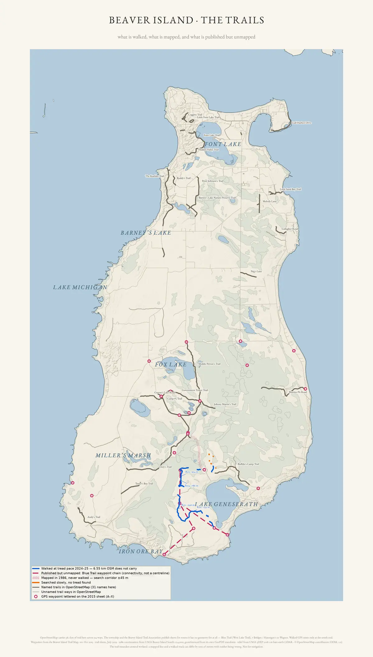
The island’s trail network drawn by the evidence for each route rather than as a single line per trail. Four registers are kept visually distinct: routes walked at tread pace with a GPS in 2024-25 that OpenStreetMap does not carry; named and unnamed trail ways OpenStreetMap does carry; the Blue Trail, published by the township and the trail association but holding no mapped geometry at all, drawn as a waypoint chain rather than a centreline; and ground searched slowly where no tread was found.
Relief is the 2018 bare-earth lidar hillshade, which shows old grades and two-tracks the modern map omits. It is not a survey and not a navigational aid: the same method missed seven of the twelve GPS-confirmed runs, a mapped line and a walked track can differ by tens of metres with neither being wrong where the trail meanders around wetland, and walked GPS exists only at the south end.
Open questions
- The Blue Trail is drawn as a waypoint chain because it holds no mapped geometry — would a tread-pace GPS walk of the full published route let it move from “published” to “mapped”?
- The lidar hillshade missed seven of the twelve GPS-confirmed runs — has the pattern of misses been checked for a common cause, such as canopy cover or narrow tread, that would improve a future pass?
If you can answer any of these, or correct anything above, the archive wants to hear it — see Corrections.
Sources
- Archive-generated trail atlas plate.Drawn from the archive's own OpenStreetMap trail extract, the walked GPS tracks of 2024-25, the trail-review package, and USGS 3DEP 2018 1 m bare-earth lidar. Map data (c) OpenStreetMap contributors (ODbL 1.0); relief and the 1986 quadrangle continuation are public domain.scripts · make_trail_map
Added 16 August 2026. Recent changes
Cite this article
Beaver Island Archive, “Beaver Island: the trails”, https://beaverislandarchive.org/map/atlas-beaver-island-trails/, accessed [date], citing Archive-generated trail atlas plate..
BibTeX for “Beaver Island: the trails”RIS for “Beaver Island: the trails”