

- Coordinates
- 45.6231° N, 85.5572° WGoogle Maps: North Lake TrailDownload KML
- Eras
- Modern era
- Concepts
- trailstransportationrecreationModern eratoponymy
- Within
- Beaver Island
- Media
- The blank directional signs at the Y, 2026 · The North Lake Trail marker at the Y, 2026
Summary
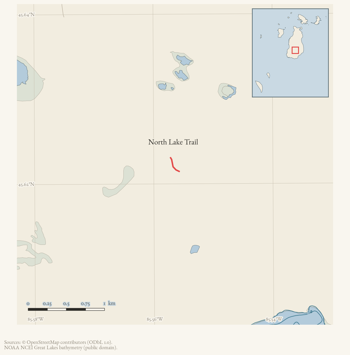
North Lake Trail is named on the 2015 map and in current OSM. The displayed geometry is the current OSM named way retrieved 2026-08-02, but the two primary sources the archive holds for this trail disagree about what it is — see below.
Official map: North Lake / Buffalo’s Camp Trail (BITA, July 2019).
The route, and a naming conflict
Peaine Township’s 2021 narrative guide treats North Lake Trail as a branch of Buffalo’s Camp Trail: at “the Y,” 1.70 miles from the Buffalo’s Camp Trail trailhead, the right (north) fork is North Lake Trail. The guide describes it as getting “very wet in 0.6 mile, standing water even in August,” joining Doty’s Camp Trail 1.17 miles from the Y, with “at least 0.3 mile of this trail close to Doty’s Camp Trail” as “just black muck, even in August.”
The Beaver Island Trail Association’s July 2019 sheet instead treats the two names as the same trail: it opens “The Buffalo’s Camp Trail, also called the North Lake Trail starts at the intersection of East Side Drive and Fishing Site Road,” and describes one route northwest from there to where it “meets Doty’s Camp Trail” — not a fork with two named branches.
A third account, walked in 2019 and contributed to this archive, agrees with the township that there is a fork — and is the only source that says what the other fork does. It has the trail curving left at a tree carrying both blue and orange diamonds, then dividing at a sign. The right fork “is the most well used and is known as the North Lake Trail and continues to Doty’s Camp Trail”; the left fork “is a continuation of the original trail but less well used and maintained and dead ends at the Blue Trail.”
Its distances sit close to the township’s without being copied from them: the divide about 1.5 miles from the trailhead against the township’s 1.70, and about 1.25 miles on to Doty’s Camp Trail against the township’s 1.17. Two independent observers putting the Y and the branch within a quarter mile of each other is the strongest evidence held that the fork is real.
It also suggests why the trail association’s sheet could fold the two names together without being wrong on the ground: if the north fork is the one people actually walk, a single-route description follows the tread rather than the names.
This article still reports the conflict rather than resolving it, following
docs/trail-articles.md. Two witnesses to a fork is not a survey, and the
mapped register remains a 243 m fragment. The fuller route description and geometry for the
shared portion is at Buffalo’s Camp Trail; this article covers the
segment both sources place north of the Y, toward Doty’s Camp Trail.
Access and ownership
Both sources place this trail in the same DNR-associated corridor as Buffalo’s Camp Trail. The 2021 township guide records a DNR “NO ORV” sign posted at the Y, where this trail (on the township’s account) begins, and the trail association’s July 2019 sheet — which describes Buffalo’s Camp Trail and North Lake Trail as one route — carries the standard BIATA disclaimer that its maps are not official DNR maps and should not be relied on for complete accuracy, current as of that date. See Buffalo’s Camp Trail for the fuller ownership record, including the DNR lease behind the shared trailhead.
There are no designated public ORV trails on Beaver Island (see Trails and trail-making).
Evidence and limits
This trail is published in both the conflicting senses described above. It is mapped: OpenStreetMap way 265424698 carries the name, but the line is only about 243 m long — far short of the 1.17-mile branch the township guide describes between the Y and Doty’s Camp Trail, so the mapped register here covers a fragment, not the branch as described. It has now been walked, once: a 2019 account contributed to this archive describes the divide and the run north to Doty’s Camp Trail with estimated distances. No GPS track is held — the nearest slow, searching movement recorded on Buffalo’s Camp Trail’s own review is 111 m away from where the fork would run — so the walked register here is a description, not a line. The swampy, black-muck ground the township guide describes is exactly the condition under which the archive’s LiDAR roughness method is least reliable.
Ground truth, or the lack of it
As of 20 August 2026 no GPS track held in this archive covers this trail. The nearest is the 16 August 2026 traverse of Buffalo’s Camp Trail, which passed 1,308 m away at its closest and turned south rather than north at the Y. The fork remains described — by the township’s distances and by a 2019 walked account — and unmapped by anything this archive can measure.
That is worth stating positively rather than leaving as an absence: the ground has not been searched and found empty, it has not been visited at all.
The fork is signed, whatever the state of the record. A photograph from that traverse shows a current, fully legible marker for this trail standing at the Y (photograph) — the island outline and a hiker pictogram over the words North Lake Trail. Two older wooden directional boards on the same post are blank (photograph). A walker reaching the junction can tell which way this trail goes; this archive still cannot say where it goes after that.
Open questions
- Is North Lake Trail a branch of Buffalo’s Camp Trail, as the township guide has it, or another name for the same trail, as the July 2019 BITA sheet has it? No source held here reconciles the two.
- OpenStreetMap’s line for this name is about 243 m; the township guide describes 1.17 miles of trail from the Y to Doty’s Camp Trail. Does the OSM way represent only a fragment, a different segment, or a misapplied name?
- Has anyone walked this trail’s full described length with a GPS? No track held here is tagged to it, and the black-muck ground it reportedly crosses is exactly the kind of stretch a walked track would settle.
If you can answer any of these, or correct anything above, the archive wants to hear it — see Corrections.
Map status
Geometry is mapped from OSM and simplified for display. Pending update: verify the line against a current official or field track.
Documented associations
No source-confirmed non-road entity is linked yet. Exact-name research leads remain in scripts/audit_road_links.py; a name collision is not treated as a road association.
Research status
The local newspaper and website corpus contains exact-name mentions in 0 file(s). Those files are research leads; the relation layer is added only when the surrounding source text establishes that the record involves this road.
Maps for this place
These Atlas plates provide regional context. They do not establish a precise boundary, current ownership, access right, operating status, or field condition.
- EnvironmentSoils, wetlands, hydrography, and terrain
- GeologyGeneralized geology and landforms
- HydrologyMapped water and wetland context
- AccessMapped routes, facilities, and protected areas
- Land surveyPLSS geometry and historic GLO patent-location context
Sources
- The legend prints North Lake Trail.
- Current named OSM way 265424698, simplified for display; volunteered geometry is not a surveyed boundary.osm · trails
- Printed pages 11-12 describe North Lake Trail as the right (north) fork at 'the Y' on Buffalo's Camp Trail, 1.70 miles from that trailhead, joining Doty's Camp Trail 1.17 miles from the Y, with a DNR 'NO ORV' sign at the fork.governance · peaine · trails · all-trail-descriptions
- States 'The Buffalo's Camp Trail, also called the North Lake Trail starts at the intersection of East Side Drive and Fishing Site Road' -- treating the two names as one trail, in conflict with the township's branch description.governance · peaine · trails · bita-north-lake-buffalos-camp-trail-2019-07
- Kamrin, Michael. 'An Insiders Guide to Beaver Island Hiking Trails: A Companion to the Wojan/Cashman Beaver Island Map.' Unpublished typescript, created 8 August 2019, last revised 17 February 2020.A third, independent account of the Y, and the only one that says what the OTHER fork does. Treats North Lake Trail as the northern section that Buffalo's Camp Trail 'splits with': at a signed divide the right fork 'is the most well used and is known as the North Lake Trail and continues to Doty's Camp Trail,' while the left fork 'is a continuation of the original trail but less well used and maintained and dead ends at the Blue Trail.' Places the divide about 1.5 miles from the trailhead and the run on to Doty's Camp Trail at about 1.25 miles. Walked, not surveyed.fieldwork · accounts · kamrin-insiders-guide-bi-hiking-trails
- Walked GPS track, Buffalo's Camp Trail trailhead to waypoint V, 16 August 2026.5.59 miles over 1,904 fixes, 19:05-21:58 UTC, 1.95 mph overall; 4.65 mi at tread pace (median 2.36 mph), 0.44 mi slow, 0.24 mi pushing through cover (median 0.67 mph). Recorded with heart rate. Exported as GPX/CSV/GeoJSON; the original FIT was not supplied, so there is no per-fix accuracy channel and canopy drift cannot be separated from the trail's real meander. Ingested by scripts/ingest_gps_track.py.fieldwork · gps_tracks · beaver-south-2026-08-16-5.59mi
Added 2 August 2026 · revised 21 August 2026. Recent changes
Cite this article
Beaver Island Archive, “North Lake Trail”, https://beaverislandarchive.org/places/north-lake-trail/, accessed [date], citing Beaver Island trails map, revised October 2015. (and 5 further sources listed on the page).
Last revised 2026-08-21. Fill in [date] with the date you read it — this page is static and cannot know that.