

Atlas · water systems
Hydrology Atlas
NHD water and flowlines, NWI wetland polygons, and EGLE hydric-soil boundaries are shown as separate layers. That distinction matters: none is a wetland delineation, drainage assessment, legal boundary, or field survey.
Read wetlands and hydrology for source limits and supporting evidence.
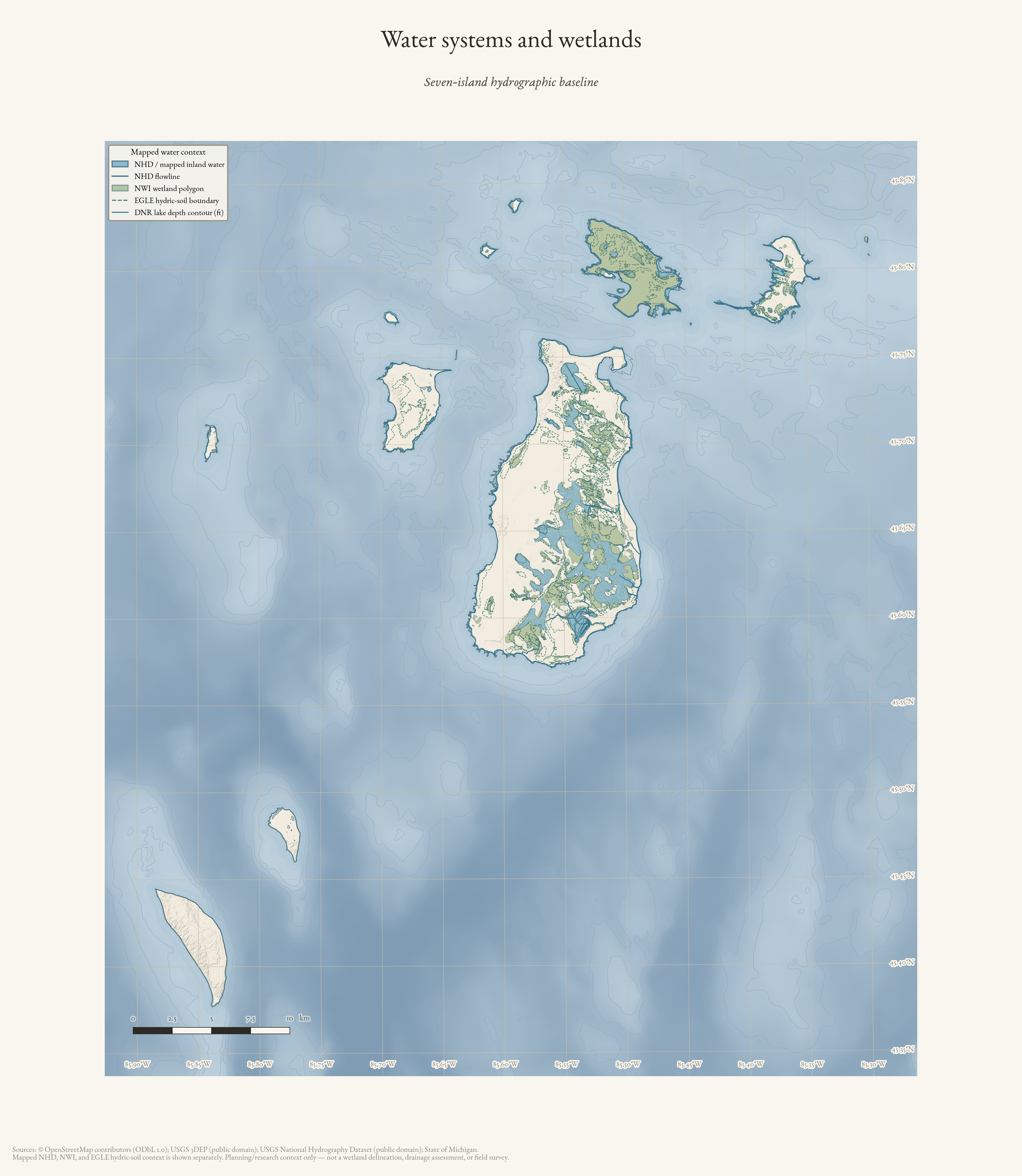
Water systems and wetlands
Seven-island hydrographic baseline: NHD water and flowlines with distinct NWI wetland and EGLE hydric-soil context.
Drawn from the archive's own data in EPSG:3078. Map data © OpenStreetMap contributors (ODbL 1.0); USGS National Hydrography Dataset, USFWS National Wetlands Inventory, Michigan EGLE hydric soils, and USGS 3DEP (public domain).
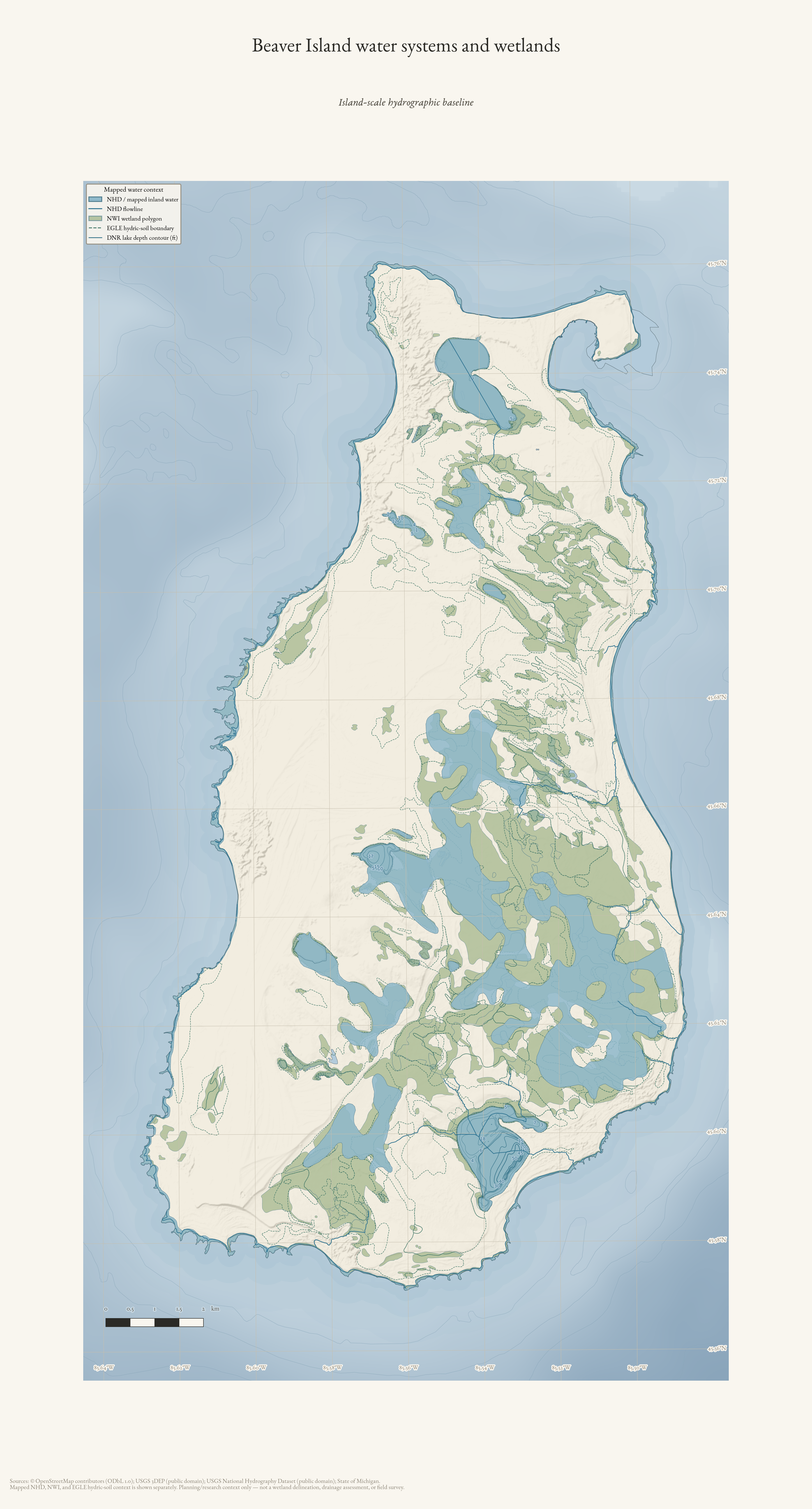
Beaver Island water systems and wetlands
Island-scale hydrographic baseline for Beaver Island: NHD water and flowlines, NWI wetland polygons, and distinct EGLE hydric-soil context.
Drawn from the archive's own data in EPSG:3078. Map data © OpenStreetMap contributors (ODbL 1.0); USGS National Hydrography Dataset, USFWS National Wetlands Inventory, Michigan EGLE hydric soils, and USGS 3DEP (public domain).