

- Date
- 1985-03
- Kind
- Disaster
- Where
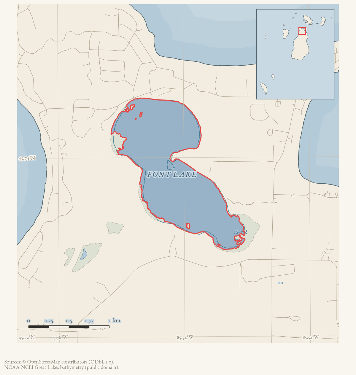
- Font Lake
- Eras
- Modern era
- Concepts
- disastergeographyinfrastructureweathercommunitycommunication
- Within
- Beaver Island
Summary
During the middle of March 1985, Font Lake reportedly breached a sand dune near the Donegal Bay Road S curve and flooded the road on its way toward Lake Michigan. Jim Wojan used a loader to rebuild the dune.
Evidence limits
The newspaper account does not provide measured water levels, a road incident log, a surveyed breach location, or evidence about how long the repair lasted.
Sources
- Reports that water washed away part of the sand dune near the Donegal Bay Road S curve, allowing Font Lake to cross the road toward Lake Michigan; vehicles reportedly drove through water above their bumpers, and Jim Wojan rebuilt the dune with a loader. It is a community report, not a hydrologic survey, road-closure log, or engineering record. The holding institution's portal restricts automated access; the archive holds a copy of this issue and can provide it on request.data1 · beaver-island-archive · beaver_beacon · 1985-04_Beaver-Beacon
- The held fourteen-page April issue PDF is paired with the canonical OCR source and confirms the flood report.data1 · beaver-island-archive · scans · beaver_beacon · issues · 1985-04_Beaver-Beacon
- Reports that Font Lake again overflowed, flooding homeowners' basements and placing Donegal Bay Road under water at several points; culverts near the campground road reportedly allowed drainage toward Lake Michigan. It is a repeated local report, not a hydrologic survey, road-closure log, or engineering record. The holding institution's portal restricts automated access; the archive holds a copy of this issue and can provide it on request.data1 · beaver-island-archive · beaver_beacon · 1985-05_Beaver-Beacon
- The held nineteen-page May issue PDF is paired with the canonical OCR source and confirms the Font Lake overflow report.data1 · beaver-island-archive · scans · beaver_beacon · issues · 1985-05_Beaver-Beacon
- Reports Font Lake's high water causing basement flooding and approaching Kings Highway, and a trench and drain under Donegal Bay Road near the St. James Township campsite, made with engineering and County Road Commission advice. It is a newspaper account of township action, not a hydrologic measurement, surveyed drainage record, or road-closure log. The holding institution's portal restricts automated access; the archive holds a copy of this issue and can provide it on request.data1 · beaver-island-archive · beaver_beacon · 1985-06_Beaver-Beacon
- The held nineteen-page June issue PDF is paired with the canonical OCR source and confirms the Font Lake drainage report.data1 · beaver-island-archive · scans · beaver_beacon · issues · 1985-06_Beaver-Beacon
Added 4 August 2026. Recent changes
Cite this article
Beaver Island Archive, “Font Lake floods Donegal Bay Road after a sand dune breach, 1985”, https://beaverislandarchive.org/events/beaver-island-font-lake-flood-1985/, accessed [date], citing “Flood,” Beaver Beacon, April 1985. (and 5 further sources listed on the page).
Last revised 2026-08-04. Fill in [date] with the date you read it — this page is static and cannot know that.
BibTeX for “Font Lake floods Donegal Bay Road after a sand dune breach, 1985”RIS for “Font Lake floods Donegal Bay Road after a sand dune breach, 1985”