

- Dates
- 1956-09 – 1957
- Kind
- Announcement
- Where
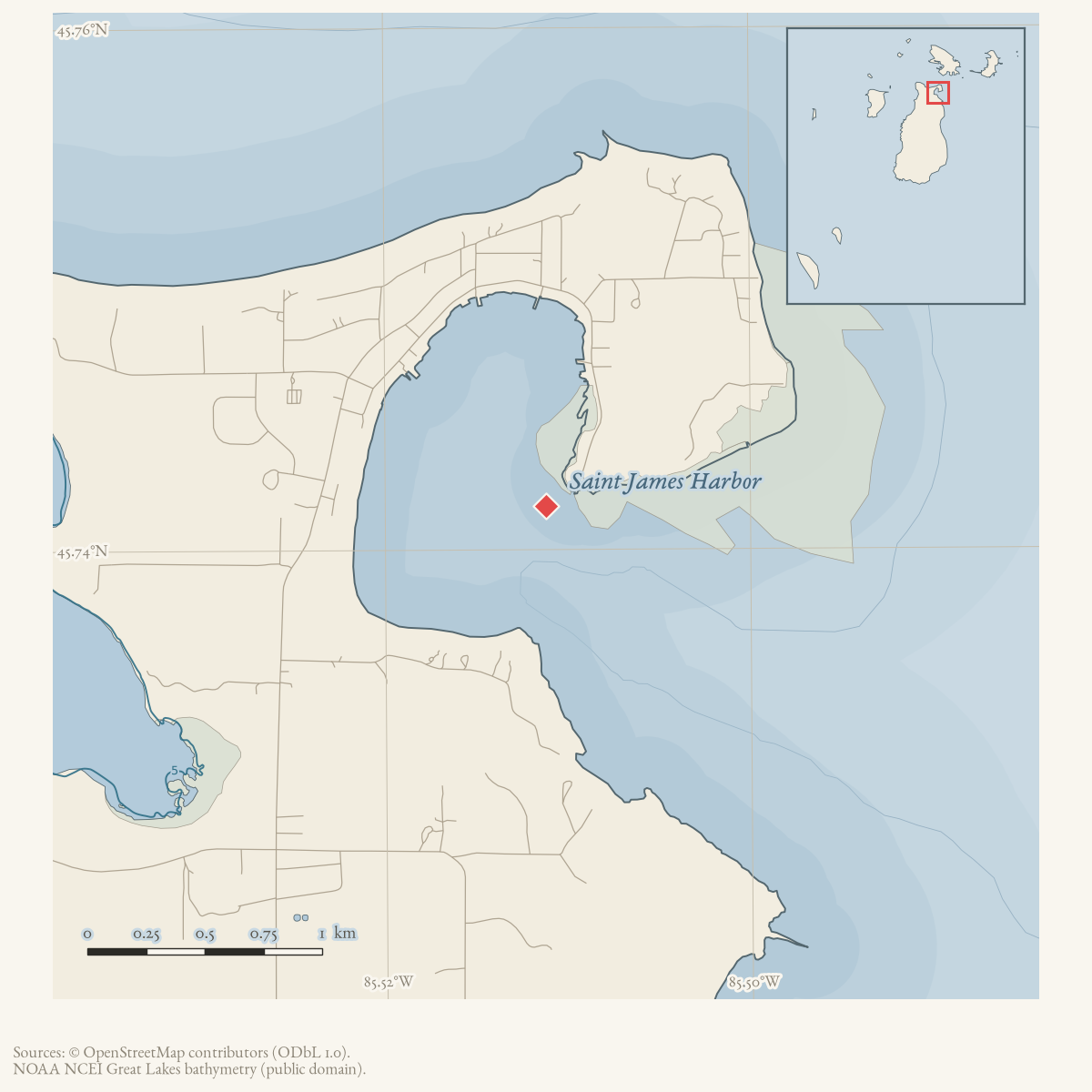
- Saint James Harbor
- Eras
- Modern era
- Concepts
- maritimeconstructiongovernancecommunication
- Within
- Beaver Island
Summary
The September 1956 Beaver Beacon reported that plans were progressing for a new municipal pleasure-craft pier on Beaver Island, with completion expected by 1957. The October issue additionally reported a State Waterways Commission appropriation for a Beaver Harbor docking-facilities survey.
Evidence and limits
These are reported planning and survey-funding notices, not a construction or completion record. The sources do not provide the appropriation amount or instrument, final site or design, permit documents, or evidence that the pier was built.
Sources
- Reports that the Michigan Waterways Commission notified the town that plans were progressing for a new municipal pleasure-craft pier, with completion expected by 1957. It does not provide a design, exact site, funding instrument, permit, construction log, or evidence that the pier was completed. The holding institution's portal restricts automated access; the archive holds a copy of this issue and can provide it on request.data1 · beaver-island-archive · beaver_beacon · 1956-09_Beaver-Beacon
- The held three-page issue scan is paired with the OCR source and confirms the reported pier plan; it does not expand the engineering, funding, or completion record.data1 · beaver-island-archive · scans · beaver_beacon · issues · 1956-09_Beaver-Beacon
- Reports that the State Waterways Commission made a recent appropriation to cover a survey of Beaver Harbor for docking facilities for the boating public. It does not provide the appropriation instrument, amount, survey results, final design, exact site, construction log, or evidence that the planned pier was completed. The holding institution's portal restricts automated access; the archive holds a copy of this issue and can provide it on request.data1 · beaver-island-archive · beaver_beacon · 1956-10_Beaver-Beacon
- The held three-page issue scan is paired with the OCR source and confirms the reported survey appropriation; it does not expand the funding, engineering, or completion record.data1 · beaver-island-archive · scans · beaver_beacon · issues · 1956-10_Beaver-Beacon
Added 3 August 2026. Recent changes
Cite this article
Beaver Island Archive, “Waterways Commission reports progress toward a Beaver Island municipal pleasure-craft pier, 1956”, https://beaverislandarchive.org/events/beaver-island-municipal-pleasure-craft-pier-plan-1956/, accessed [date], citing Beaver Beacon, September 1956, “Waterways.” (and 3 further sources listed on the page).
Last revised 2026-08-03. Fill in [date] with the date you read it — this page is static and cannot know that.
BibTeX for “Waterways Commission reports progress toward a Beaver Island municipal pleasure-craft pier, 1956”RIS for “Waterways Commission reports progress toward a Beaver Island municipal pleasure-craft pier, 1956”