

- Along road
- Buff-Kett Road · Kett-Gillespie Drive · Buff-Malloy Drive
- Coordinates
- 45.6976° N, 85.5745° WGoogle Maps: Buff-Kett subdivisionDownload KML
- Eras
- Modern era
- Concepts
- housingland-usecommunity
- Within
- Beaver Island
Summary
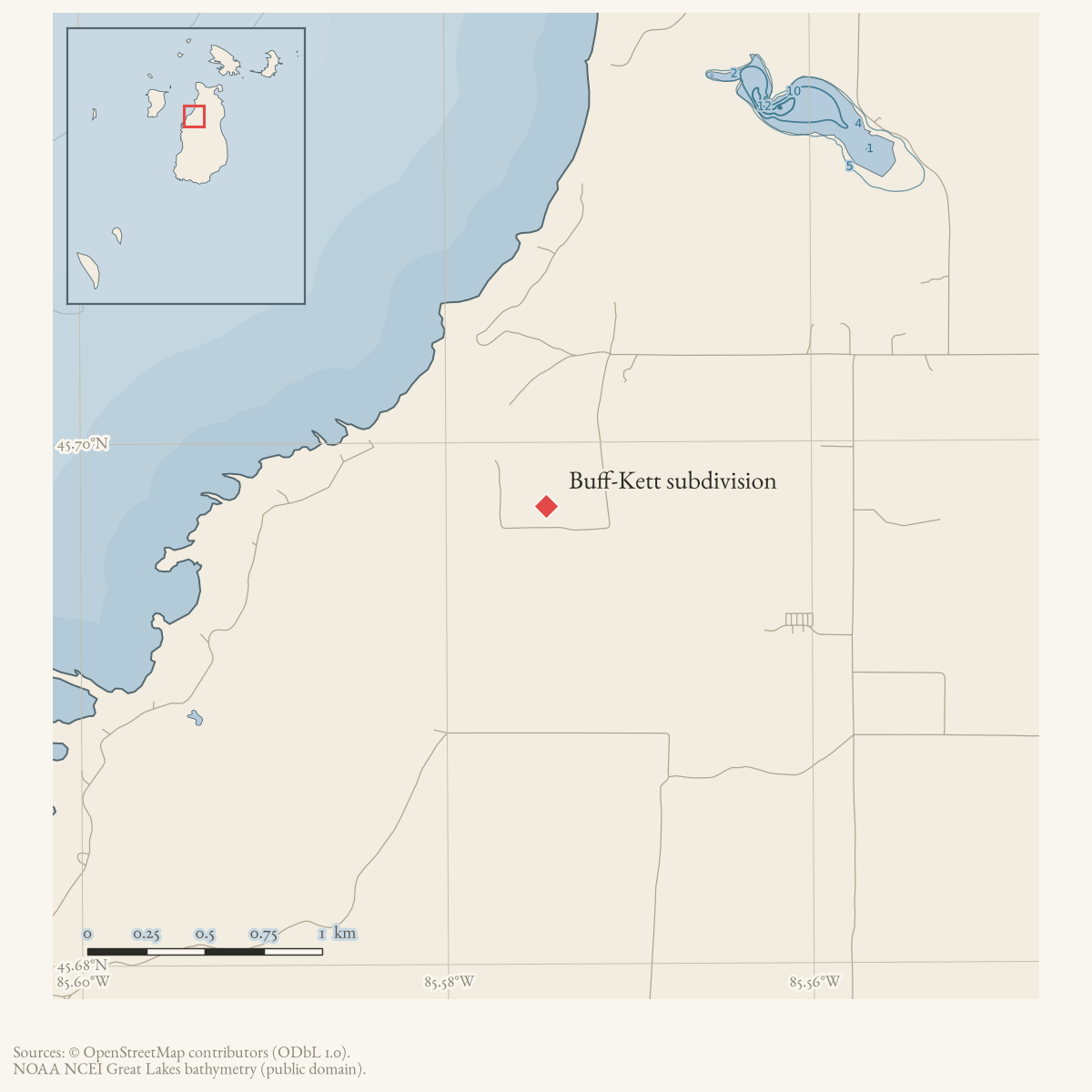
Buff-Kett is a source-qualified subdivision name preserved in county parcel and tax-roll records. The dated parcel snapshot places Buff-Kett lot labels beside Buff-Kett Road, Kett-Gillespie Drive, and Buff-Malloy Drive, providing a useful road-level research bridge.
The association is administrative and approximate. The held records do not establish the subdivision’s full boundary, road dedication, access rights, or current ownership.
Maps for this place
These Atlas plates provide regional context. They do not establish a precise boundary, current ownership, access right, operating status, or field condition.
- EnvironmentSoils, wetlands, hydrography, and terrain
- GeologyGeneralized geology and landforms
- HydrologyMapped water and wetland context
- AccessMapped routes, facilities, and protected areas
- Land surveyPLSS geometry and historic GLO patent-location context
Sources
- Described in this archive: Current named-feature and property join records.Dated parcel rows use Buff-Kett lot labels with property-site road labels Buff-Kett Road, Kett Gillespie Drive, and Buff-Malloy Drive. The snapshot does not publish a plat image or legal boundary here and must not be read as a current-owner, title, access, or complete road-frontage assertion.county · charlevoix · parcels_arcgis · 2026-08-01 · island_parcel_attributes
- The point at approximately -85.5745348, 45.6975546 is the mean of current parcel-record centroids whose legal or property-road labels identify Buff-Kett. It is a cluster representative for map navigation, not a subdivision centroid derived from a recorded plat or a boundary geometry.county · charlevoix · parcels_arcgis · 2026-08-01 · island_parcel_attributes
- Charlevoix Courier, 1995 tax-roll publication.A published tax list includes a Buff-Kett lot label, corroborating historical circulation of the subdivision name; it does not provide a road map or complete plat history. No public copy of this file is known; the archive holds one and can provide it on request.
Added 2 August 2026. Recent changes
Cite this article
Beaver Island Archive, “Buff-Kett subdivision”, https://beaverislandarchive.org/places/buff-kett-subdivision/, accessed [date], citing Public Charlevoix County parcel FeatureServer snapshot, retrieved 2026-08-01. (and 2 further sources listed on the page).
Last revised 2026-08-02. Fill in [date] with the date you read it — this page is static and cannot know that.
BibTeX for “Buff-Kett subdivision”RIS for “Buff-Kett subdivision”