

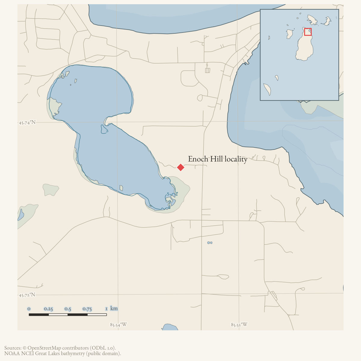
- Along road
- Enoch Hill Road
- Coordinates
- 45.7347° N, 85.5295° WGoogle Maps: Enoch Hill localityDownload KML
- Eras
- Modern era
- Concepts
- settlementtoponymycommunity
- Within
- Beaver Island
- Media
- Beaver Island History Map, 1978 revision
Summary
Enoch Hill is a source-qualified locality or address name associated with Beaver Island’s current Enoch Hill Road. A February 1966 Beaver Beacon item refers to correspondence addressed to Enoch Hill on Beaver Island, providing an older local attestation than the current map.
The held source does not establish a separate settlement, exact extent, or the origin of the road name. This record therefore remains a research lead rather than a mapped place boundary.
Maps for this place
These Atlas plates provide regional context. They do not establish a precise boundary, current ownership, access right, operating status, or field condition.
- EnvironmentSoils, wetlands, hydrography, and terrain
- GeologyGeneralized geology and landforms
- HydrologyMapped water and wetland context
- AccessMapped routes, facilities, and protected areas
- Land surveyPLSS geometry and historic GLO patent-location context
Sources
- The item says Wini and Lawrence McDonough received a letter addressed to Enoch Hill on Beaver Island. It documents local use of the name as an address or locality but does not define a settlement boundary or identify a separate village.data1 · beaver-island-archive · beaver_beacon · 1966-02_Beaver-Beacon
- The held seven-page issue scan is paired with the OCR source and confirms the published notice or report; it does not expand the source-specific identity, event, or outcome claims.data1 · beaver-island-archive · scans · beaver_beacon · issues · 1966-02_Beaver-Beacon
- The current mapped route carries the related name Enoch Hill Road. This is a volunteered map record and does not by itself prove the historical locality-road naming relationship.osm · roads
- The point is a representative point on the named current road, not an inferred settlement boundary or exact historical address.
Added 2 August 2026 · revised 3 August 2026. Recent changes
Cite this article
Beaver Island Archive, “Enoch Hill locality”, https://beaverislandarchive.org/places/enoch-hill-locality/, accessed [date], citing Beaver Beacon, February 1966, “Beaver Island Irish.” (and 3 further sources listed on the page).
Last revised 2026-08-03. Fill in [date] with the date you read it — this page is static and cannot know that.
BibTeX for “Enoch Hill locality”RIS for “Enoch Hill locality”