

- Along road
- Greene's Lake Road
- Coordinates
- 45.6374° N, 85.5856° WGoogle Maps: Greenes Lake Public AccessDownload KML
- Eras
- Modern era
- Concepts
- transportationrecreationconservation
- Within
- Beaver Island
Summary
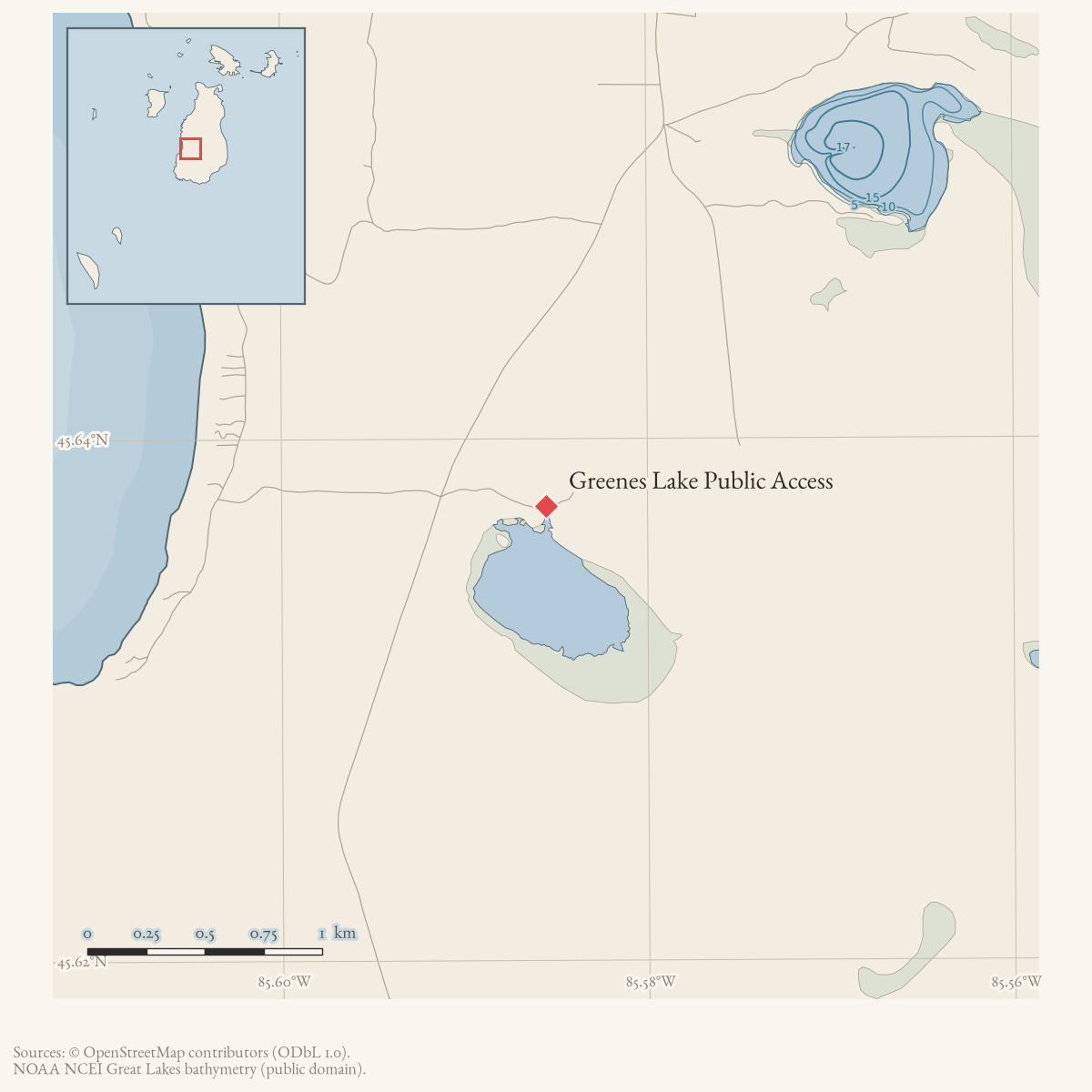
Greenes Lake Public Access is a fishing access site listed in the Beaver Island recreation-facilities inventory. The inventory places it on Greene’s Lake Road and identifies Michigan DNR ownership; a later DNR–Peaine lease names Greene’s Lake Boat Access among the leased recreation sites. The county snapshot adds a dated DNR parcel context under PIN 012-131-005-00, but does not resolve the facility itself.
Evidence and limits
The sources establish a road-linked public-access designation, not a surveyed facility boundary, easement, construction history, or current condition.
Open questions
- What parcel and access easement define the site?
- Does the current DNR–Peaine lease still govern it?
- Can a current map resolve its point or polygon geometry?
Maps for this place
These Atlas plates provide regional context. They do not establish a precise boundary, current ownership, access right, operating status, or field condition.
- EnvironmentSoils, wetlands, hydrography, and terrain
- GeologyGeneralized geology and landforms
- HydrologyMapped water and wetland context
- AccessMapped routes, facilities, and protected areas
- Land surveyPLSS geometry and historic GLO patent-location context
Sources
- Nearest road-to-water point used as an approximate access proxy because the recreation inventory places the site at Greene’s Lake Road; it is not a surveyed access parcel or launch footprint.osm · roads
- The inventory lists Greene’s Lake Public Access at Greene’s Lake Road, owned by the Michigan DNR and used for fishing. It does not establish a parcel boundary, exact access point, easement, construction date, or current condition.planning · beaver_island_master_plan · 2017-beaver-island-resilient-master-plan-8cbeebcd
- Names Greene’s Lake Boat Access among the DNR-leased Peaine public-recreation sites; it does not independently locate the access point or establish current access.research · island_governance · peaine-lake-geneserath-dnr-lease
- PIN 012-131-005-00 is a 160.8-acre parcel owned by the Michigan Department of Natural Resources, with situs Greene’s Lake Road and legal description DNR #606. Its representative point is several hundred metres from the road-to-water proxy and is retained only as broader DNR ownership context; it is not treated as the launch point, an access easement, or a surveyed facility boundary.county · charlevoix · parcels_arcgis · 2026-08-01 · island_parcel_attributes
Added 2 August 2026 · revised 6 August 2026. Recent changes
Cite this article
Beaver Island Archive, “Greenes Lake Public Access”, https://beaverislandarchive.org/places/greenes-lake-public-access/, accessed [date], citing OpenStreetMap, Greene’s Lake Road and Greene’s Lake water features, downloaded 2026-08-06. (and 3 further sources listed on the page).
Last revised 2026-08-06. Fill in [date] with the date you read it — this page is static and cannot know that.
BibTeX for “Greenes Lake Public Access”RIS for “Greenes Lake Public Access”