

- Coordinates
- 45.5786° N, 85.5340° WGoogle Maps: Kelly PointDownload KML
- Eras
- Modern era
- Concepts
- toponymymaritimetourism
- Within
- Beaver Island
- Media
- Beaver Island History Map, 1978 revision
Summary
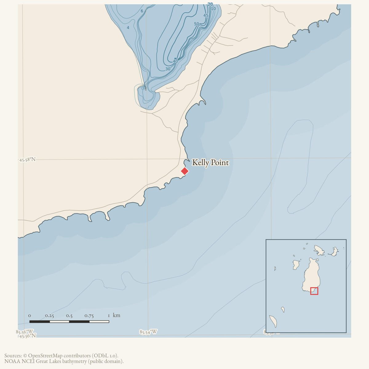
Kelly Point is a GNIS-named cape on Beaver Island. The current OpenStreetMap
snapshot contains a matching natural=cape node carrying GNIS feature 629555.
Several Beaver Island tour maps reproduced in the 1980 Charlevoix Courier
also label Kelly Point, documenting continued cartographic and tourism use of
the name. A 1929 grounding report proves that the name was already in ordinary
regional use. A 1948 island column says the point was named for the father of
one of the Kelly women whose family settled after the Mormon departure, but
does not identify him. The Historical Map’s more specific “John Kelly (1863)”
therefore remains unresolved.
Open questions
- Was the unnamed Kelly father in the 1948 account John Kelly, and what event does 1863 represent?
- Can nautical charts, property records, or local accounts define the point’s historical use?
Sources
- GNIS feature 629555; feature class 'Cape'.federal · gnis · gnis_names
- Node 7177560725 is named Kelly Point, tagged natural=cape, and carries GNIS feature 629555.osm · natural
- Charlevoix Courier, 1980, Beaver Island tour maps.Multiple illustrated Beaver Island tour maps in the 1980 Courier label Kelly Point; the maps establish geographic use but do not provide a name origin. No public copy of this file is known; the archive holds one and can provide it on request.
- Charlevoix Sentinel, November 7, 1929, “Patrol No. 1 Runs Aground—Released by Tug Venus.”Contemporary report places the Conservation Department patrol boat grounding on Kelly Point and describes it as ten or twelve miles south of St. James. It establishes the place name by 1929, not its origin. No public copy of this file is known; the archive holds one and can provide it on request.
- Charlevoix Courier, July 29, 1948, Beaver Island column.Later island report says the point nearest Charlevoix was named for the father of one of the Kelly women born on Beaver Island after her family settled shortly after the Mormon exodus. The clipped column does not name the father or give a naming year. No public copy of this file is known; the archive holds one and can provide it on request.
- Described in this archive: Beaver Island History Map, 1978 revision.Attributes the point to John Kelly and gives 1863. Those two details have not been independently corroborated.
Added 28 July 2026 · revised 7 August 2026. Recent changes
Cite this article
Beaver Island Archive, “Kelly Point”, https://beaverislandarchive.org/places/kelly-point/, accessed [date], citing U.S. Geological Survey, Geographic Names Information System, Domestic Names (Michigan), retrieved 2026-07-28. (and 5 further sources listed on the page).
Last revised 2026-08-07. Fill in [date] with the date you read it — this page is static and cannot know that.