

- Along road
- Sloptown Road
- Coordinates
- 45.7035° N, 85.5745° WGoogle Maps: Piper's CornerDownload KML
- Eras
- Modern era
- Concepts
- toponymyheritagetourism
- Within
- Beaver Island
- Media
- Beaver Island History Map, 1978 revision
Summary
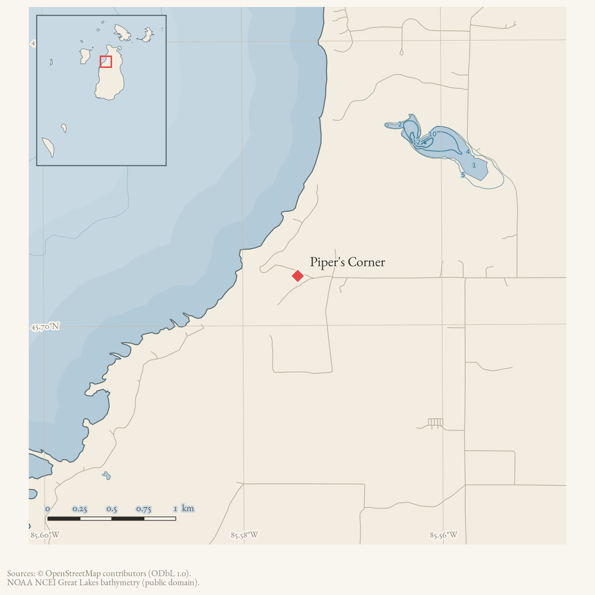
Piper’s Corner is a locally used Beaver Island locality near Sloptown Road and Bonners’. A Helen Collar research-card note places it just east of Bonners’ and attributes the name to Dan Gallagher, called “Piper.” A February 2026 Northern Islander family-history feature independently uses Piper’s Corner as a reference point for the Boyle family farm and its memorial stone. That interview spells the road “Sloatown”; the current road entity preserves the otherwise consistently attested Sloptown form.
The locality is recorded as a draft place because the held sources establish local usage and an attributed name tradition, but do not provide a surveyed coordinate, formal boundary, or independently verified biography of Dan Gallagher.
The 1978 Historical Map expands this to “three generations” of Piper Gallaghers. A 1981 obituary firmly documents Daniel C. and Mary Ann Gallagher’s eleven children at the corner and says the family moved away in 1916. It does not by itself establish three generations of residence, so the map’s generation count remains a defined genealogical and property-research question.
Open questions
- Where exactly did historical maps and land records place Piper’s Corner?
- Which Dan Gallagher was called Piper, and when did the name enter local use?
- Can the memorial stone and the Boyle farm be documented through property or cemetery records?
- Which three generations did the 1978 map intend, and did each reside at the corner rather than merely belong to the family line?
Maps for this place
These Atlas plates provide regional context. They do not establish a precise boundary, current ownership, access right, operating status, or field condition.
- EnvironmentSoils, wetlands, hydrography, and terrain
- GeologyGeneralized geology and landforms
- HydrologyMapped water and wetland context
- AccessMapped routes, facilities, and protected areas
- Land surveyPLSS geometry and historic GLO patent-location context
Sources
- A local research-card note places Piper's Corner just east of Bonners' and attributes the name to a Dan Gallagher called Piper. The card does not provide a map, date, or underlying citation beyond “P. 141.”web · collar_subject_cards_q-z
- Michelle LaFreniere, “On the Front Porch with Eleanor McDonough,” *Northern Islander*, February 2026.Eleanor McDonough's family account spells the road “Sloatown Road” and places her maternal grandparents' farm near Piper's Corner, with a memorial stone at the corner. Current historical-society, township-plan, and map sources use Sloptown Road; the interview spelling is retained as a variant. This is a present-day local geographic and commemorative attestation, not a surveyed boundary. No public copy of this file is known; the archive holds one and can provide it on request.
- The approximate point is placed on the east side of the Bonner's Landing/Sloptown Road area, using the local account's “just east of Bonners'” description and the current named road network. It is a research-map anchor, not a surveyed corner or memorial-stone coordinate.
- Identifies Kathryn as the last of eleven children of Daniel C. and Mary Ann “Piper” Gallagher raised at Piper’s Corner, says the family moved away in 1916, and records that her parents operated a boarding house there. The holding institution's portal restricts automated access; the archive holds a copy of this issue and can provide it on request.data1 · beaver-island-archive · beaver_beacon · 1981-02_Beaver-Beacon
- Described in this archive: Beaver Island History Map, 1978 revision.Says three generations of Piper Gallaghers lived there. The namesake household and children are corroborated, but a complete three-generation residence chain remains unproved.
Added 31 July 2026 · revised 7 August 2026. Recent changes
Cite this article
Beaver Island Archive, “Piper's Corner”, https://beaverislandarchive.org/places/pipers-corner/, accessed [date], citing Helen Collar Papers, Beaver Island history subject cards, Q-Z, Place Names, Clarke Historical Library, Central Michigan University, retrieved 2026. (and 4 further sources listed on the page).
Last revised 2026-08-07. Fill in [date] with the date you read it — this page is static and cannot know that.