

- Along road
- Tamarack Trail
- Coordinates
- 45.7485° N, 85.5513° WGoogle Maps: Port St. James Tamarack Trail lotsDownload KML
- Eras
- Modern era
- Concepts
- land-surveyland-useeconomy
- Within
- Beaver Island
Summary
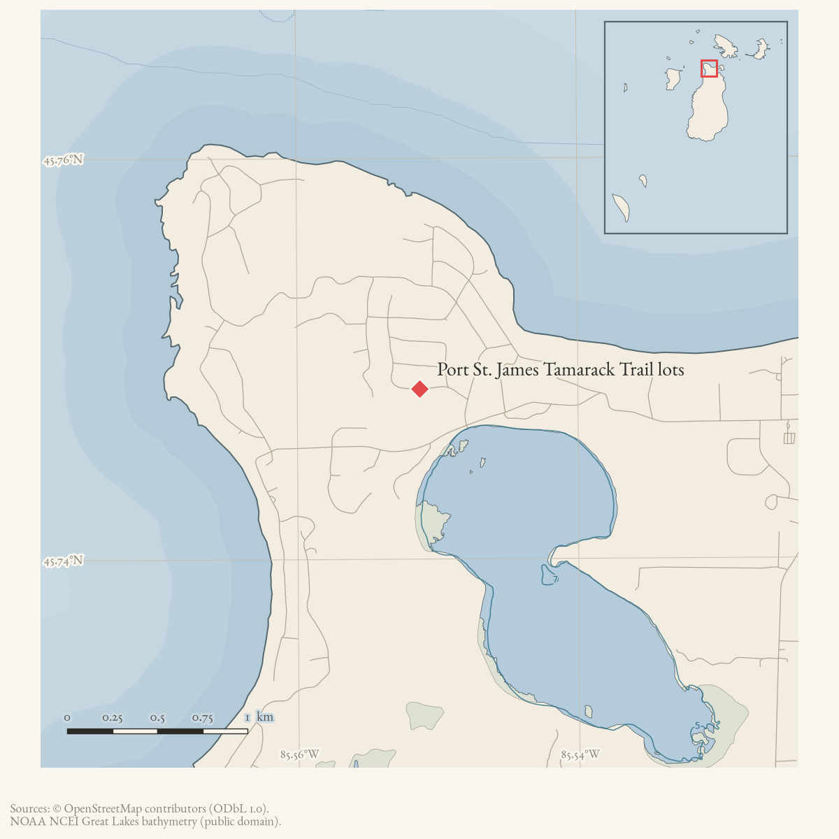
January and February 2001 Beaver Beacon classified advertisements offered two wooded, perked, powered lots in Port St. James on Tamarack Trail Road at $9,500 each. The map point is the current Tamarack Trail route point, retained as an approximate road-level locator because the listing does not identify lot numbers or a plat.
This is a source-qualified listing record. It does not establish a completed sale, subdivision plat, exact lot identifiers, or current parcel geometry. The displayed point belongs to the named road, not to either lot. Tamarack Trail is itself a platted subdivision street rather than a recreational trail; the “Trail” in the address is a street suffix, not evidence that the lots front a walking route.
Access and ownership
The listing is a private classified advertisement by an unnamed “owner,” not a plat filing, deed, or broker record; the archive holds no evidence of who platted the lots, whether they were part of a numbered Port St. James phase, or whether the sale went through. Tamarack Trail’s own ownership is likewise not established from the archive’s holdings — see that article for what the county parcel snapshot and township road-commission record do and do not show.
Evidence and limits
The only evidence held for this record is a published classified advertisement, repeated across two 2001 issues, and its own December 2000 first appearance (see Tamarack Trail). No plat map, deed, or county parcel record has been matched to the specific lots offered; the map point here is a road-level approximation, not a surveyed parcel location.
Open questions
- Which Port St. James plat and lot numbers correspond to the listing?
- Were the lots sold or developed after 2001?
- Can county parcel records confirm the Tamarack Trail frontage?
If you can answer any of these, or correct anything above, the archive wants to hear it — see Corrections.
Maps for this place
These Atlas plates provide regional context. They do not establish a precise boundary, current ownership, access right, operating status, or field condition.
- EnvironmentSoils, wetlands, hydrography, and terrain
- GeologyGeneralized geology and landforms
- HydrologyMapped water and wetland context
- AccessMapped routes, facilities, and protected areas
- Land surveyPLSS geometry and historic GLO patent-location context
Sources
- Offers two wooded lots in Port St. James on Tamarack Trail Road, says they are perked and powered, and gives an asking price of $9,500 each. The February issue repeats the listing. These are advertisements, not deeds, surveys, completed sales, or exact parcel polygons. The holding institution's portal restricts automated access; the archive holds a copy of this issue and can provide it on request.data1 · beaver-island-archive · beaver_beacon · 2001-01_Beaver-Beacon
- The held twenty-seven-page issue scan is paired with the OCR source and confirms the published notice or report; it does not expand the source-specific identity, event, or outcome claims.data1 · beaver-island-archive · scans · beaver_beacon · issues · 2001-01_Beaver-Beacon
- Repeats the two Port St. James Tamarack Trail Road lots at $9,500 each. It adds no deed, buyer, plat, or parcel geometry. The holding institution's portal restricts automated access; the archive holds a copy of this issue and can provide it on request.data1 · beaver-island-archive · beaver_beacon · 2001-02_Beaver-Beacon
- The held twenty-two-page issue scan is paired with the OCR source and confirms the published notice or report; it does not expand the source-specific identity, event, or outcome claims.data1 · beaver-island-archive · scans · beaver_beacon · issues · 2001-02_Beaver-Beacon
- The coordinate is the current route representative point for Tamarack Trail, the named road in the listing; it is not either advertised lot’s parcel point.osm · roads
Added 2 August 2026 · revised 16 August 2026. Recent changes
Cite this article
Beaver Island Archive, “Port St. James Tamarack Trail lots”, https://beaverislandarchive.org/places/tamarack-trail-port-st-james-lots-2001/, accessed [date], citing Beaver Beacon, January 2001, classified advertising. (and 4 further sources listed on the page).
Last revised 2026-08-16. Fill in [date] with the date you read it — this page is static and cannot know that.
BibTeX for “Port St. James Tamarack Trail lots”RIS for “Port St. James Tamarack Trail lots”