

- Date
- circa 1849
- Eras
- Early American era
- Concepts
- land-surveytoponymyheritageenvironment
- Within
- Beaver Island archipelago
Summary
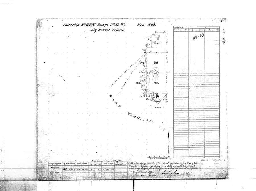
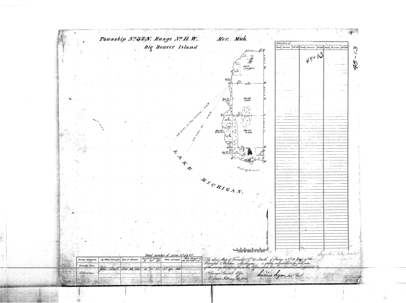
This article represents the held image-only GLO survey plat for T37N R11W. The project provenance identifies the original plat series as approved circa 1849. The scan shows a federal survey township/range title, section geometry, water boundaries, survey annotations, and a survey table. It is a cartographic survey record, not a list of occupants or a parcel-ownership history.
Direct image observations
- The primary sheet title identifies Township No. 37 N., Range No. 11 W., Michigan Meridian; the map is a Lake Michigan island survey with section lines.
These observations are a first-pass reading of the scan, not an exhaustive transcription of every small label, bearing, acreage entry, or handwritten note. The PDF is cited directly so later work can verify each reading at native resolution.
Joinable survey and environmental records
The held PLSS section layer places this sheet in T37N R11W (MI190370N0110W0) and
connects it to 8 section records. The circa-1800 land-cover
reconstruction intersects that modern township geometry in 4
units. These are reproducible comparison joins: they make the scan searchable
alongside section and environmental records, but they do not mean that every
linked polygon or label appears on the image.
PLSS sections
- PLSS section 12, MI190370N0110W0
- PLSS section 13, MI190370N0110W0
- PLSS section 01, MI190370N0110W0
- PLSS section 02, MI190370N0110W0
- PLSS section 23, MI190370N0110W0
- PLSS section 11, MI190370N0110W0
- PLSS section 14, MI190370N0110W0
- PLSS section 24, MI190370N0110W0
Circa-1800 land-cover units
- Circa-1800 land-cover unit 63814: Beech-Sugar Maple-Hemlock Forest
- Circa-1800 land-cover unit 63900: Mixed Conifer Swamp
- Circa-1800 land-cover unit 63909: Cedar Swamp
- Circa-1800 land-cover unit 63911: Mixed Conifer Swamp
GNIS and map comparisons
The modern GNIS layer contributes 0 feature points and 0 name-record links within the same geometry. GNIS is a modern gazetteer comparison, not evidence that a current name was used on the circa- 1849 sheet. The 1855 Lake Survey chart is retained as an independent historical map comparison.
GNIS name records
Neighboring held plats
The held collection includes 2 cardinally adjacent plat sheets for navigation across township and range boundaries.
What it can and cannot establish
The plat can establish how the federal survey represented the township and which labels or water features were put on that sheet. It can support comparison with the 1853 Farmer map, the 1855 Lake Survey chart, GNIS, and the machine-readable PLSS section records. It does not establish who lived on or owned a parcel; that requires patents, tract books, deeds, tax records, and other residence evidence.
Open questions
- What exact survey and approval dates can be transcribed from the primary title block at native resolution?
- Which small feature labels can be matched confidently to current GNIS or PLSS records?
- Do the missing field notes or patents preserve people, trails, camps, or ownership information absent from this image?
See also
- General Land Office survey plats for the Beaver Island archipelago
- Land survey and settlement geography
- Historical toponymy and map change
- Pre-settlement landscape and environmental history
- North End of Lake Michigan Including the Beaver Island Group, 1855 Lake Survey chart
- Strang's biblical toponyms
- PLSS section 12, MI190370N0110W0
- PLSS section 13, MI190370N0110W0
The page
Rendered from the held scan.
Sources
- The held scan has SHA-256 47acddfe9d84317c07f55ed07bb82024ba3e8d6e18d40119b484702e8b729af9. GLO survey plat, T37N R11W, Beaver archipelago (originals approved c. 1849, Lucius Lyon surveyor general; 'BIG BEAVER I.' / 'GARDEN ISLAND' labels). Image-only PDF; direct observations are listed in the article body.federal · glo_plats · 37n11w
- Project provenance sidecar for the held GLO plat.Records retrieval time, checksum, public-domain status, and the project source note. No public copy of this file is known; the archive holds one and can provide it on request.federal · glo_plats · 37n11w.provenance
- The plat is connected to 8 section records by matching township/range identifier MI190370N0110W0; this is a modern geometry join, not a transcription of every label on the scan.federal · plss · plss_section
- 4 reconstructed land-cover units intersect the modern PLSS geometry for T37N R11W; this is a comparative spatial index, not a claim that each unit is legible on the plat.state · michigan · land_cover_circa_1800
- 0 GNIS feature points fall within the modern PLSS geometry used as the plat extent; linked name-record articles preserve the current gazetteer layer separately from the historical image.federal · gnis · gnis_names
Added 1 August 2026. Recent changes
Cite this article
Beaver Island Archive, “GLO survey plat: T37N R11W”, https://beaverislandarchive.org/documents/glo-plat-t37n-r11w/, accessed [date], citing Michigan Department of Natural Resources State Spatial Data Library, GLO survey plat 37n11w. (and 4 further sources listed on the page).
Last revised 2026-08-01. Fill in [date] with the date you read it — this page is static and cannot know that.
BibTeX for “GLO survey plat: T37N R11W”RIS for “GLO survey plat: T37N R11W”