

- Date
- 1995-09-10
- Kind
- Disaster
- Where
- Blue Trail
- Along road
- Blue Trail
- Eras
- Modern era
- Concepts
- disasterenvironmenttransportation
- Within
- Beaver Island
Summary
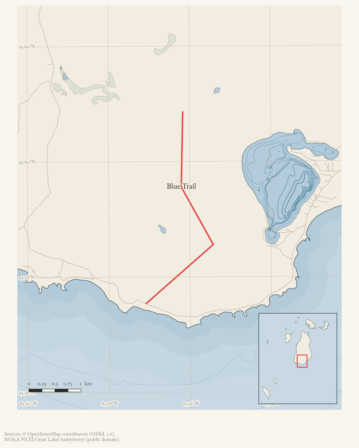
On September 10, 1995, an underground fire was reported near the middle of Beaver Island’s Blue Trail. The contemporaneous Beaver Beacon described the Blue walking trail as a multiple-path route from King’s Highway and Hannigan’s Road toward the South End Lighthouse.
The report establishes the dated occurrence and its trail context and points to a fresh lightning scar near the burning stump as the apparent explanation. It does not establish the exact ignition mechanism, acreage, or a surveyed location.
Open questions
- Did the underground fire near the lightning-struck stump reoccur or spread, or was it contained on its own?
- Where along the Blue Trail’s route from King’s Highway/Hannigan’s Road toward the South End Lighthouse did the fire occur?
If you can answer any of these, or correct anything above, the archive wants to hear it — see Corrections.
Sources
- Describes the Blue walking trail as an approximately eight-mile, multiple-path route from King’s Highway and Hannigan’s Road toward the South End Lighthouse and reports an underground fire near the trail’s middle. It reports a fresh lightning scar near the burning stump as the apparent explanation, but does not provide coordinates, acreage, or a separate fire-service incident record. The holding institution's portal restricts automated access; the archive holds a copy of this issue and can provide it on request.data1 · beaver-island-archive · beaver_beacon · 1995-10_Beaver-Beacon
- The held eighteen-page issue scan is paired with the OCR source and confirms the published notice or report; it does not expand the source-specific identity, event, or outcome claims.data1 · beaver-island-archive · scans · beaver_beacon · issues · 1995-10_Beaver-Beacon
Added 2 August 2026 · revised 3 August 2026. Recent changes
Cite this article
Beaver Island Archive, “Underground fire on the Blue Trail, 1995”, https://beaverislandarchive.org/events/blue-trail-underground-fire-1995/, accessed [date], citing Beaver Beacon, October 1995, “Sept 10: Forest Fire on the Blue Trail.” (and 1 further source listed on the page).
Last revised 2026-08-03. Fill in [date] with the date you read it — this page is static and cannot know that.
BibTeX for “Underground fire on the Blue Trail, 1995”RIS for “Underground fire on the Blue Trail, 1995”