

- Coordinates
- 45.7736° N, 85.3615° WGoogle Maps: Horseshoe IslandDownload KML
- Eras
- Modern era
- Concepts
- environmentvegetationwildlifebirdsconservationmaritime
- Within
- Beaver Island archipelago
Summary
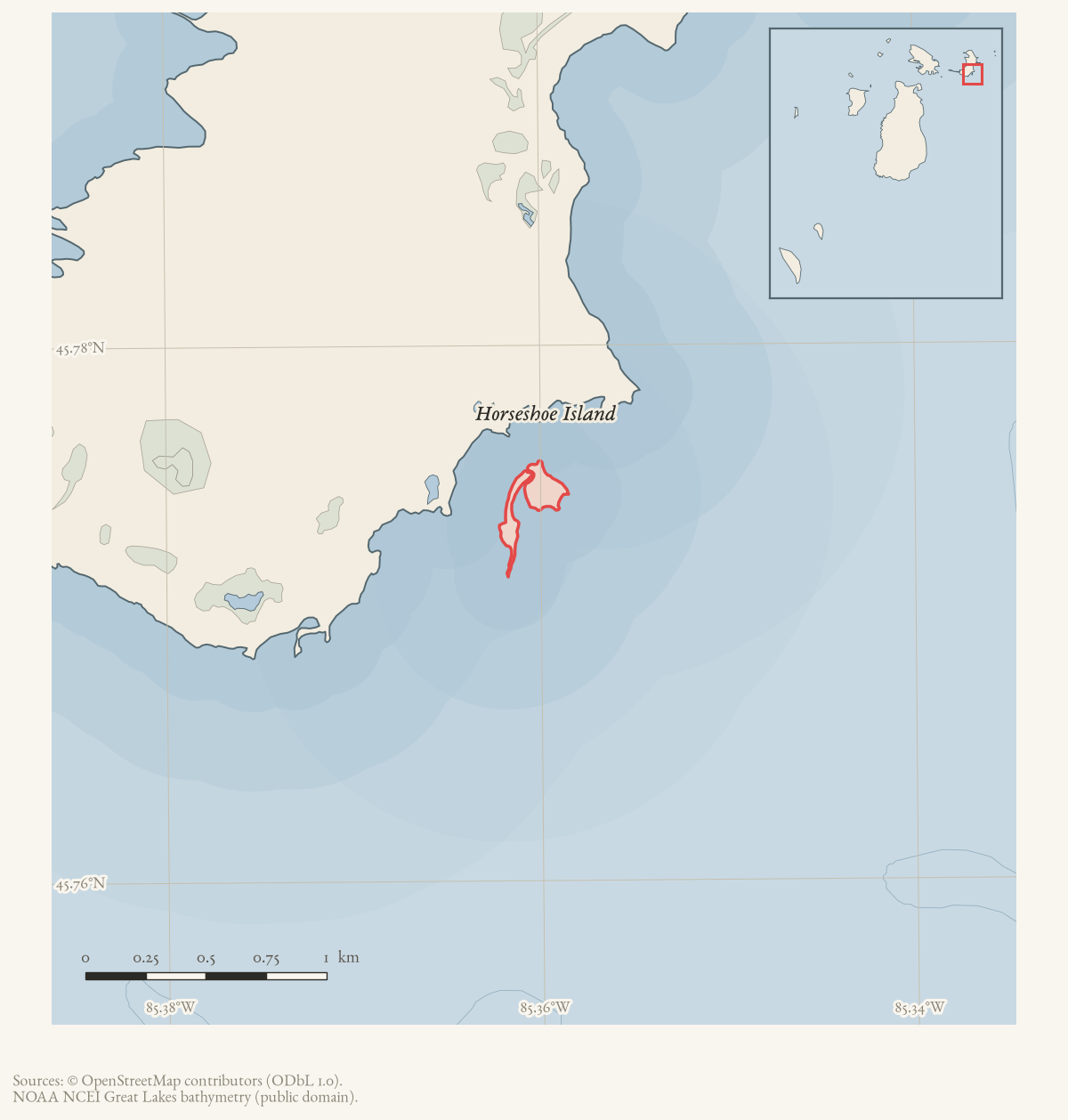
Horseshoe Island is a GNIS-named island in the Beaver Island archipelago. The current OpenStreetMap island snapshot contains a matching multipolygon relation (2203896) carrying GNIS feature 628605 and calculates an area of approximately 0.04 km². This establishes current mapped identity and geometry, but the name’s origin, ownership, ecology, and local history remain unresolved.
Ecological profile
The 1993 MNFI statewide island table gives Horseshoe Island a bounded legacy ecology record: Common Tern (Sterna hirundo) and Pitcher’s thistle (Cirsium pitcheri) are listed for the island. The plant and bird entries are important evidence that the island was included in a biodiversity comparison, but they do not establish abundance, nesting success, present persistence, or the habitat conditions supporting either record. The current DNR parcel layer adds management and spatial context through a 2-acre Wildlife Division parcel whose legal-description text names Horseshoe Island; it is not a substitute for a contemporary ecological survey.1
Open questions
- Who or what gave Horseshoe Island its name?
- What ownership, habitat, and navigation records describe the island?
Footnotes
-
Soule, Biodiversity of Michigan’s Great Lakes Islands (1993), Charlevoix County island table; Michigan DNR parcel 2022351. ↩
Maps for this place
These Atlas plates provide regional context. They do not establish a precise boundary, current ownership, access right, operating status, or field condition.
- EnvironmentSoils, wetlands, hydrography, and terrain
- GeologyGeneralized geology and landforms
- HydrologyMapped water and wetland context
- AccessMapped routes, facilities, and protected areas
- Land surveyPLSS geometry and historic GLO patent-location context
Sources
- Area 0.04 km² computed in EPSG:3078.osm · islands
- Judith D. Soule, *Biodiversity of Michigan’s Great Lakes Islands: Knowledge, Threats and Protection*, MNFI Report 1993-10 (1993).Described in this archive: Soule, Biodiversity of Michigan's Great Lakes Islands, 1993.The Charlevoix County island table lists Common Tern (*Sterna hirundo*) and Pitcher’s thistle (*Cirsium pitcheri*) for Horseshoe Island. This statewide legacy table is not a current population census, habitat map, or complete plant inventory. No public copy of this file is known; the archive holds one and can provide it on request.research · wildlife · mnfi_biodiversity_great_lakes_islands_1993
- Described in this archive: Michigan DNR parcel record 2022351.The parcel record reports 2.0 acres, Wildlife Division, and legal-description text “Horseshoe Island in Lake Michigan (CCN 005).” It is a management/geometry record, not a complete ownership chain or ecological inventory.state · michigan · dnr_parcels
- Project-generated outer-island and legacy ecology evidence index (2026).Described in this archive: Outer-island and legacy ecology evidence index.Provides the connected ecology-index context and preserves source-specific limits; it does not create a Horseshoe Island population estimate. No public copy of this file is known; the archive holds one and can provide it on request.research · wildlife · indices · outer_island_ecology_evidence_index
Added 28 July 2026 · revised 3 August 2026. Recent changes
Cite this article
Beaver Island Archive, “Horseshoe Island”, https://beaverislandarchive.org/places/horseshoe-island/, accessed [date], citing OpenStreetMap contributors, island polygons via Overpass API, retrieved 2026-07-28 (ODbL 1.0). (and 3 further sources listed on the page).
Last revised 2026-08-03. Fill in [date] with the date you read it — this page is static and cannot know that.