

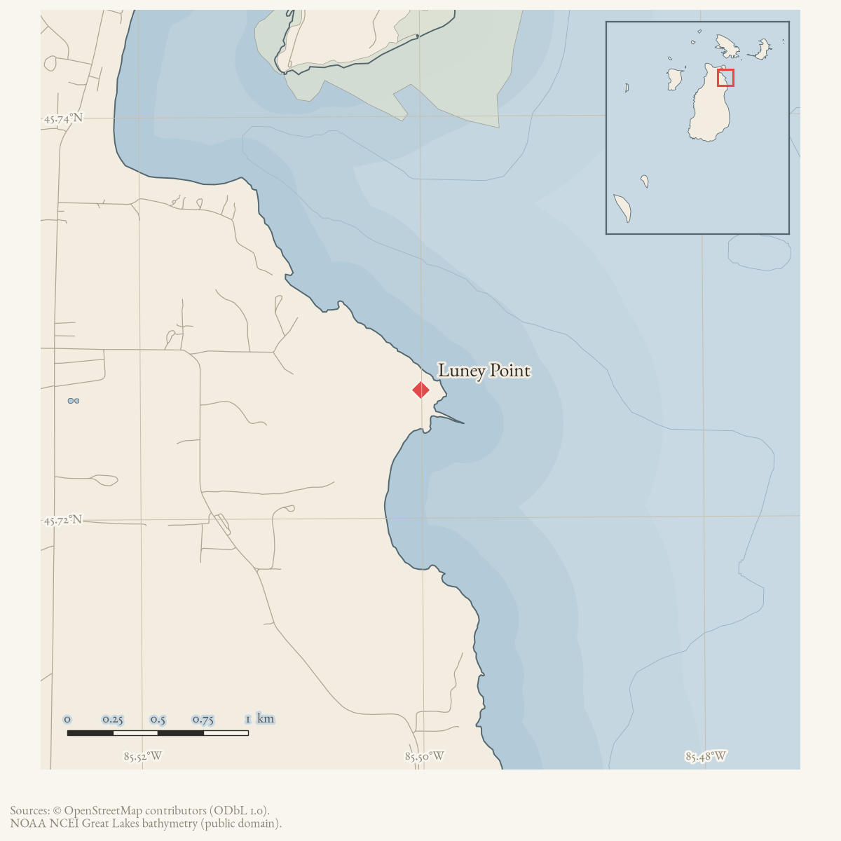
- Coordinates
- 45.7264° N, 85.5001° WGoogle Maps: Luney PointDownload KML
- Eras
- Modern era
- Concepts
- toponymy
- Within
- Beaver Island
Summary
USGS GNIS identifies Luney Point as a cape and says that Patrick Luney settled there in 1846. Elizabeth Whitney Williams’s 1905 eyewitness memoir uses the spelling “Loaney,” places the family there before the Mormons, and identifies Mr. Loaney as the second keeper of the south-end lighthouse after Van Allen. The 2023 Beaver Island Master Plan labels the feature “Luney’s Point” on its map and GNIS records Looney Point, Stony Point, and Strong Point as variants. This article currently preserves those attestations without assuming that the settlement account explains every later name form. The 1978 map’s claim that Patrick sold the farm to Strang for $40 in 1855 remains unverified, and Williams does not supply the keeper’s first name; treating the two records as the same Patrick is therefore probable, not conclusive.
Open questions
- Can a government patent or county deed document Patrick/“Loaney,” including the alleged 1855 sale to Strang for $40?
- Can Lighthouse Service appointment records identify the second keeper’s full name and service dates?
- Which variant spellings occur in dated island maps and newspapers?
Sources
- GNIS feature 631061; feature class 'Cape'.federal · gnis · gnis_names
- Feature 631061 description says Patrick Luney settled at the point in 1846.federal · gnis · gnis_feature_descriptions
- Variant names: Looney Point; Stony Point; Strong Point.federal · gnis · gnis_variant_names
- Map label “Luney's Point.”
- Williams knew the family as “Loaney.” She says they settled at the point before the Mormons, that the place always bore the Loaney name, and that Mr. Loaney returned after 1856 to become the second keeper of the south-end Beaver Island lighthouse after Van Allen. She does not give his first name or a land-sale price.
- Described in this archive: Beaver Island History Map, 1978 revision.Names Patrick Luney, circa 1846 settlement, an alleged 1855 sale to Strang for $40, and second-keeper service. Williams independently supports the settlement context and keeper sequence, but the deed claim has not been verified.
Added 28 July 2026 · revised 7 August 2026. Recent changes
Cite this article
Beaver Island Archive, “Luney Point”, https://beaverislandarchive.org/places/luney-point/, accessed [date], citing U.S. Geological Survey, Geographic Names Information System, Domestic Names (Michigan), retrieved 2026-07-28. (and 5 further sources listed on the page).
Last revised 2026-08-07. Fill in [date] with the date you read it — this page is static and cannot know that.