

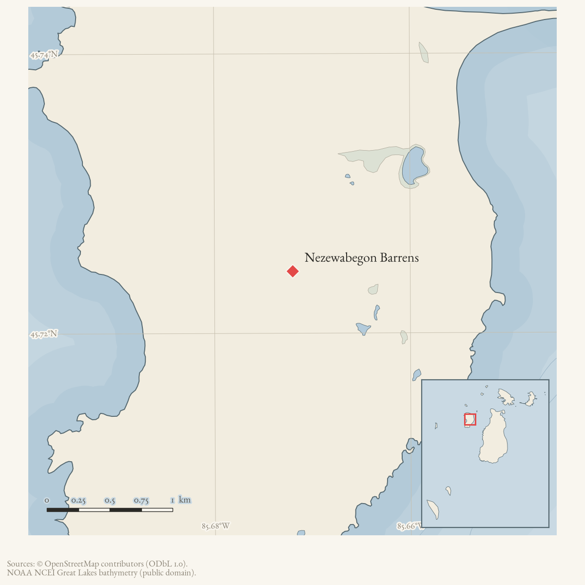
- Coordinates
- 45.7244° N, 85.6720° WGoogle Maps: Nezewabegon BarrensDownload KML
- Eras
- Modern era
- Concepts
- environmentgeologysoilsdunesforeststreesvegetationplantsconservationstewardshipinvasive-species
- Within
- High Island
Summary
Nezewabegon Barrens is a source-defined 19-acre Great Lakes barrens occurrence on High Island (MNFI EO 20454, rank AB, G3/S2; Report 2017-11, pp. 53–54). The barrens occupies a small dune field between low foredune and sand/gravel beach or limestone cobble shore, with dry-mesic, boreal, and mesic northern forest inland.
The coordinate is the containing High Island locator, not the occurrence boundary or centroid. The MNFI occurrence is not a current legal boundary, ownership determination, or complete survey of High Island.
Ecological profile
The coastal dunes formed from glacial sediment reworked by streams and waves, then transported inland by strong winds. The barrens’ wind-blown and wave-worked dune sands are alkaline, about pH 8.0, with shallow 1–2-centimeter slightly acidic organic layers around pH 6.5–6.7 in places. The site is stable enough for trees to establish while retaining open barrens structure.
The scattered canopy includes white pine, red pine, northern white-cedar, white spruce, red oak, paper birch, and balsam fir. A cored 28.8-centimeter red pine was estimated at 53 years old. Canopy closure is generally 10–25 percent and increases inland; many trees are open-grown with broad, sprawling branches. The understory includes white pine, cedar, spruce, trembling aspen, paper birch, serviceberry, and choke cherry. Common juniper and bearberry dominate the dense low-shrub layer, with creeping juniper, sand cherry, soapberry, red-osier dogwood, choke cherry, and yew.
The sparse to patchy ground layer includes wormwood, starry false Solomon’s seal, white camas, little bluestem, plains puccoon, wild strawberry, silverweed, sand reed grass, marram grass, wheat grass, common milkweed, and bastard-toadflax. Pitcher’s thistle and Lake Huron tansy occur locally and are state-threatened plants.
MNFI identifies invasive plants as a threat, including mossy stonecrop, narrow-leaved cattail, invasive common reed, and white sweet-clover along the nearby shoreline. Its recommendations are to allow natural processes, remove clusters of non-native plants within the barrens and adjacent shore, and monitor both areas for invasion. These observations do not establish current plant occupancy, treatment success, or present barrens geometry.
Open questions
- Can the barrens polygons be located against current High Island dune, beach, and land-status data without treating the occurrence as a parcel?
- What later surveys document Pitcher’s thistle, Lake Huron tansy, invasive plants, or changes in the open-to-forest transition?
Maps for this place
These Atlas plates provide regional context. They do not establish a precise boundary, current ownership, access right, operating status, or field condition.
- EnvironmentSoils, wetlands, hydrography, and terrain
- GeologyGeneralized geology and landforms
- HydrologyMapped water and wetland context
- AccessMapped routes, facilities, and protected areas
Sources
- Project-generated MNFI 2017 soil, vegetation, and wildlife crosswalk, preserving MNFI Report 2017-11, Nezewabegon Barrens Great Lakes barrens occurrence (EO 20454), report pp. 53–54.Described in this archive: MNFI soil, vegetation, tree, and wildlife crosswalk, 2017.The 19-acre record is a named MNFI natural-community occurrence on High Island; it is not a current legal boundary, ownership determination, or complete survey of the island. No public copy of this file is known; the archive holds one and can provide it on request.research · island_farming · crosswalks · mnfi_soil_vegetation_wildlife_crosswalk
- Visual page evidence held with provenance sidecar; the image anchors the occurrence description and does not establish modern geometry or current condition.research · island_farming · evidence · mnfi-report-2017-11-page-0053-nezewabegon-barrens
- The mapped High Island point is used as an approximate containing-island locator. It is not the boundary or centroid of the 19-acre MNFI barrens occurrence.osm · islands
Added 3 August 2026 · revised 6 August 2026. Recent changes
Cite this article
Beaver Island Archive, “Nezewabegon Barrens”, https://beaverislandarchive.org/places/nezewabegon-barrens/, accessed [date], citing Project-generated MNFI 2017 soil, vegetation, and wildlife crosswalk, preserving MNFI Report 2017-11, Nezewabegon Barrens Great Lakes barrens occurrence (EO 20454), report pp. 53–54. (and 2 further sources listed on the page).
Last revised 2026-08-06. Fill in [date] with the date you read it — this page is static and cannot know that.
BibTeX for “Nezewabegon Barrens”RIS for “Nezewabegon Barrens”