

- Coordinates
- 45.8047° N, 85.4945° WGoogle Maps: Taganing Dune and SwaleDownload KML
- Eras
- Modern era
- Concepts
- environmentgeologysoilsdunesforeststreesvegetationplantswetlandshydrologyconservationstewardshipinvasive-species
- Within
- Garden Island
Summary
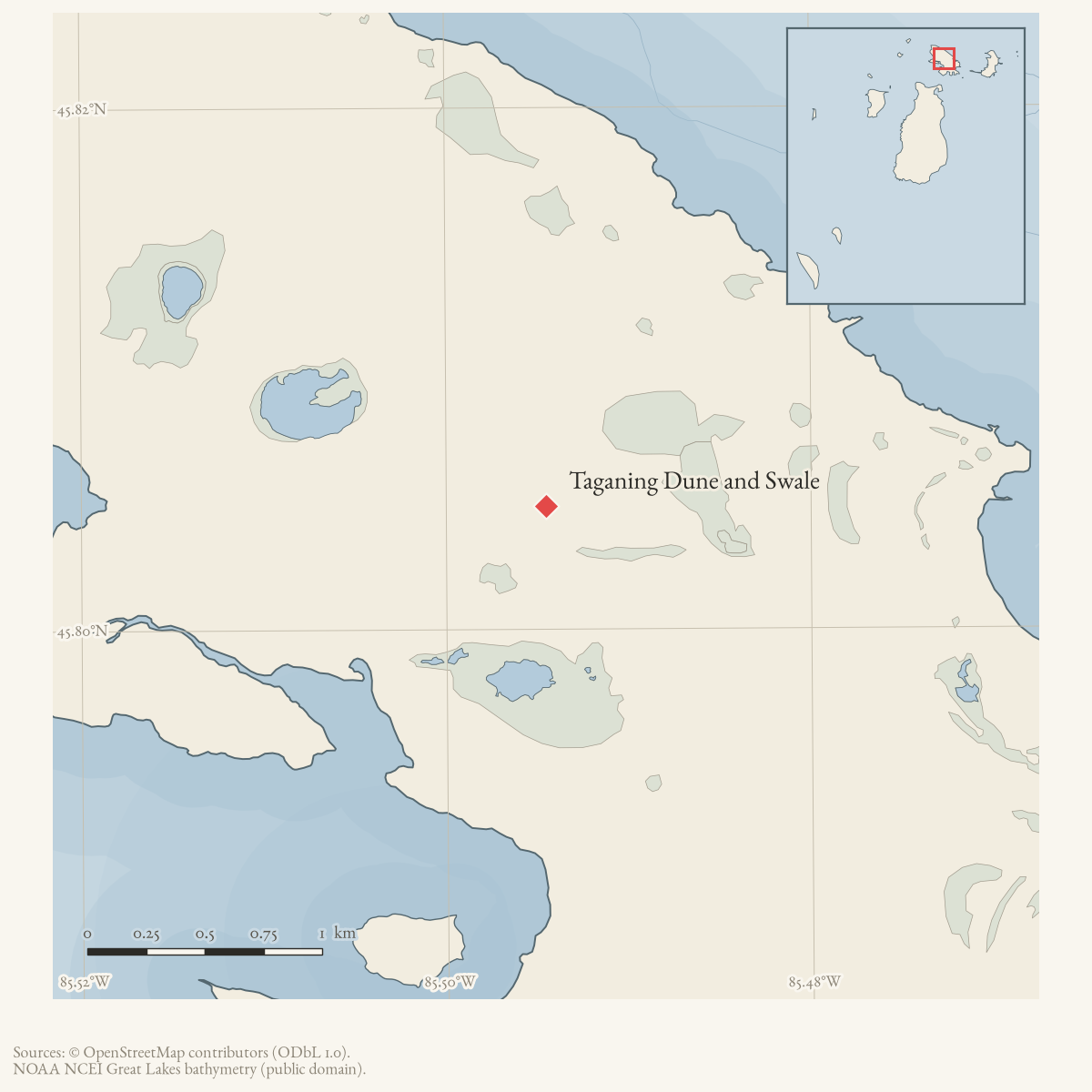
Taganing Dune and Swale is a source-defined MNFI wooded dune and swale complex on Garden Island. MNFI Report 2017-11 records 67 acres (EO 20451, report pp. 151–153; rank C, G3/S3). Its name connects the modern natural-community record to the island’s documented Taganing toponym, but the occurrence remains distinct from the island boundary and from any legal parcel or protected-area geometry. The coordinate is the containing Garden Island locator, not the occurrence boundary or centroid.
Ecological profile
Lacustrine processes over hundreds to thousands of years produced northeast– southwest dune ridges and swales of varying depth and width. Ridge soils have a 10–30 cm acidic organic-and-sand A horizon (pH 4.5) over medium- to coarse- textured alkaline sands (pH 7.5–7.8); the needle layer makes the surface more acidic than deeper sand. Shrub and meadow swales contain saturated alkaline peat (pH 7.5–8.0), more than one metre deep in one swale, over sand. Standing water in sedge- and shrub-dominated swales measured 30–60 cm deep.
The complex contains dry-mesic northern forest, northern hardwood swamp, rich conifer swamp, northern shrub thicket, and northern wet meadow. A 31.5 cm northern white-cedar from a dry-mesic ridge was estimated at more than 133 years old. Ridge canopy trees are commonly 10–30 cm DBH, with northern white-cedar dominant and paper birch, trembling aspen, and red pine as associates. Balsam fir and yew are common in the understory; mountain maple and Labrador tea occur in the low shrub layer. Bracken fern, Canada mayflower, wild sarsaparilla, twinflower, gay-wings, starflower, and naked miterwort are characteristic ground cover.
The wetland mosaic changes with swale type. Northern hardwood swales are black-ash dominated; rich conifer swales are dominated by northern white-cedar with black ash and tamarack; shrub swales support tag alder, red-osier dogwood, mountain holly, Labrador tea, alder-leaved buckthorn, and bog rosemary; and graminoid meadows are dominated by tussock and wiregrass sedges, wild blue flag, marsh fern, marsh cinquefoil, and hardstem bulrush. Fallen trees from uplands provide establishment substrate, while paper birch and balsam fir contribute abundant early-successional coarse woody debris.
Windthrow is common on ridges and swales. Charred snags and cut stumps indicate past fire and local logging, while the survey found no current threats. MNFI recommends allowing natural processes to continue, retaining an intact natural buffer, and monitoring for invasive species. These are source-bounded recommendations, not a current fire history, hydrologic monitoring record, or complete inventory of Garden Island’s dune, forest, and wetland communities. The occurrence is not a current legal boundary or ownership determination, and it is not a complete survey of Garden Island’s dune and swale systems.
Open questions
- Can the occurrence be located against Garden Island’s current land-status, wetland, and topographic data without treating its polygon as a legal parcel?
- What later surveys document water depth, cedar age structure, fire history, coarse woody debris, or invasive-species trends in the swales?
Maps for this place
These Atlas plates provide regional context. They do not establish a precise boundary, current ownership, access right, operating status, or field condition.
- EnvironmentSoils, wetlands, hydrography, and terrain
- GeologyGeneralized geology and landforms
- HydrologyMapped water and wetland context
- AccessMapped routes, facilities, and protected areas
Sources
- Project-generated MNFI 2017 soil, vegetation, and wildlife crosswalk, preserving MNFI Report 2017-11, Taganing Dune and Swale wooded dune and swale complex occurrence (EO 20451), report pp. 151–153.Described in this archive: MNFI soil, vegetation, tree, and wildlife crosswalk, 2017.The 67-acre record is a named MNFI natural-community occurrence on Garden Island, not a current legal boundary, ownership determination, or complete survey of the island’s dune and swale systems. No public copy of this file is known; the archive holds one and can provide it on request.research · island_farming · crosswalks · mnfi_soil_vegetation_wildlife_crosswalk
- Visual page evidence held with provenance sidecar; the image anchors the occurrence description and does not establish modern geometry or current condition.research · island_farming · evidence · mnfi-report-2017-11-page-0151-taganing-dune-swale
- GNIS feature 626637 supplies the containing-island point used as an approximate locator. It is not the boundary or centroid of the 67-acre MNFI dune-and-swale occurrence.federal · gnis · gnis_names
Added 3 August 2026 · revised 6 August 2026. Recent changes
Cite this article
Beaver Island Archive, “Taganing Dune and Swale”, https://beaverislandarchive.org/places/taganing-dune-and-swale/, accessed [date], citing Project-generated MNFI 2017 soil, vegetation, and wildlife crosswalk, preserving MNFI Report 2017-11, Taganing Dune and Swale wooded dune and swale complex occurrence (EO 20451), report pp. 151–153. (and 2 further sources listed on the page).
Last revised 2026-08-06. Fill in [date] with the date you read it — this page is static and cannot know that.
BibTeX for “Taganing Dune and Swale”RIS for “Taganing Dune and Swale”