

- Date
- 1688
- Eras
- French era
- Concepts
- toponymyheritageFrench era
- Within
- Beaver Island archipelago
Summary
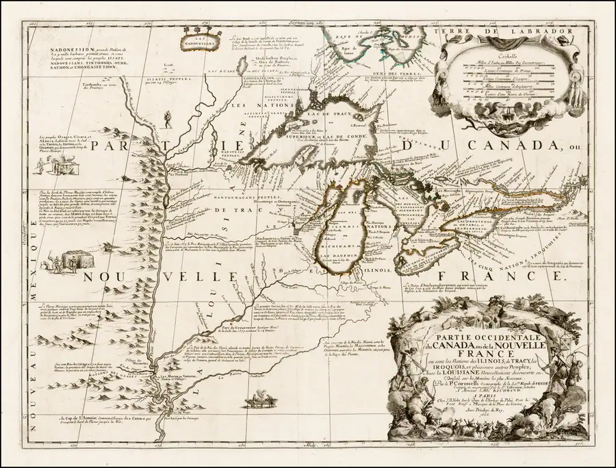
The held Coronelli map associates a northern Lake Michigan island cluster with the form Outtaou-uactz (Ottawas). It is the project’s early Ottawa-associated cartographic evidence, not an interchangeable historical name for Beaver Island.
Evidence and limits
The map is regional and the feature correspondence is source-qualified rather than exact. It does not establish a modern island-by-island identity, an Odawa or Ojibwe community’s self-designation, title, occupation, or the origin of the later French Beaver/Castor terminology.
See also
Sources
- The held-map provenance identifies a northern Lake Michigan island cluster as labeled “Outtaou-uactz” (Ottawas). The source is retained as an Ottawa-associated cartographic label, not silently normalized to Beaver Island or treated as a Beaver/Castor name, a community self-description, or a precise modern-boundary claim.maps · commons · coronelli_1688_partie_occidentale
- Project provenance sidecar for Coronelli 1688 map.Records the Commons source URL, retrieval timestamp, checksum, dimensions, the Gallica copy reference, and public-domain status. No public copy of this file is known; the archive holds one and can provide it on request.maps · commons · coronelli_1688_partie_occidentale.provenance

Added 2 August 2026 · revised 4 August 2026. Recent changes
Cite this article
Beaver Island Archive, “Coronelli Partie Occidentale du Canada, 1688”, https://beaverislandarchive.org/documents/coronelli-partie-occidentale-du-canada-1688/, accessed [date], citing Vincenzo Coronelli, *Partie Occidentale du Canada ou de la Nouvelle France* (1688), held map scan. (and 1 further source listed on the page).
Last revised 2026-08-04. Fill in [date] with the date you read it — this page is static and cannot know that.
BibTeX for “Coronelli Partie Occidentale du Canada, 1688”RIS for “Coronelli Partie Occidentale du Canada, 1688”