

- Date
- 1703
- Eras
- French era
- Concepts
- toponymyheritageFrench era
- Within
- Beaver Island archipelago
Summary
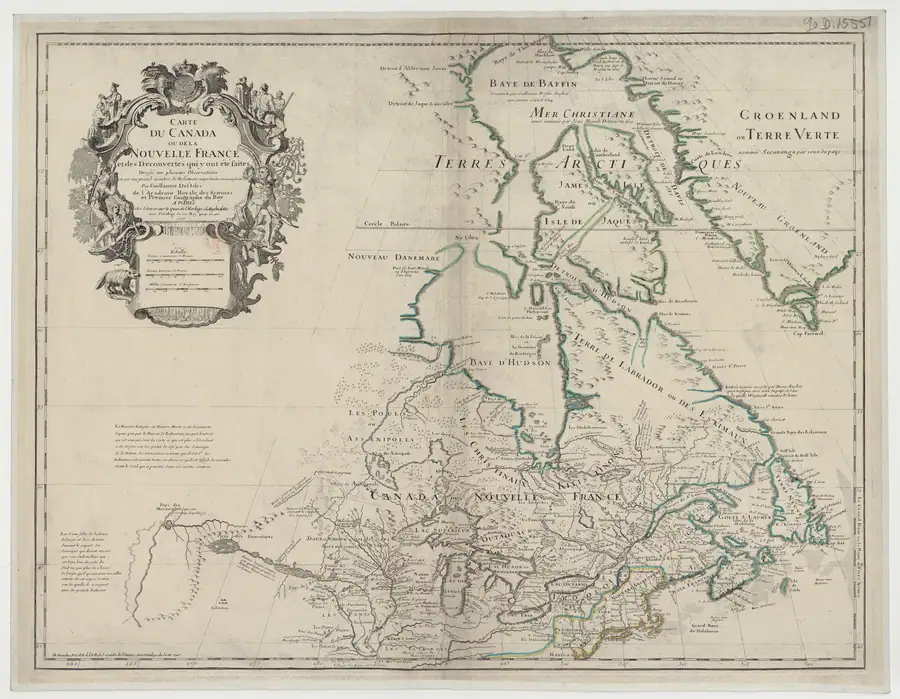
The held 1703 de l’Isle map depicts the Beaver Island group but supplies no Beaver/Castor label for it. Its nearby Isles des Poutouatami label belongs at Green Bay and is not silently reassigned to Beaver Island.
Evidence and limits
This source refines the chronology of what a mapmaker printed; it is not proof of local speech, an ethnic affiliation for the Beaver Island group, a modern feature boundary, or an origin date for the later French name.
Open questions
- Whether de l’Isle’s manuscript sources for this stretch of the lake differed from those behind Franquelin’s 1688 map has not been traced.
- The island-by-island count within the drawn group cannot be read with confidence at this map’s scale and has not been attempted here.
See also
Sources
- The held-map provenance identifies the Beaver Island group as drawn but unlabeled; “Isles des Poutouatami” appears at Green Bay rather than on the Beaver group. This is negative cartographic evidence, not proof of absence from local language, an ethnographic statement about the islands, or an exact modern-feature boundary.maps · commons · delisle_1703_carte_du_canada
- Project provenance sidecar for de l’Isle 1703 map.Records the Gallica/Commons source URL, checksum, dimensions, and public-domain status. No public copy of this file is known; the archive holds one and can provide it on request.maps · commons · delisle_1703_carte_du_canada.provenance

Added 2 August 2026 · revised 4 August 2026. Recent changes
Cite this article
Beaver Island Archive, “de l’Isle Carte du Canada, 1703”, https://beaverislandarchive.org/documents/delisle-carte-du-canada-1703/, accessed [date], citing Guillaume de l’Isle, *Carte du Canada ou de la Nouvelle France* (Paris, 1703), held map scan. (and 1 further source listed on the page).
Last revised 2026-08-04. Fill in [date] with the date you read it — this page is static and cannot know that.
BibTeX for “de l’Isle Carte du Canada, 1703”RIS for “de l’Isle Carte du Canada, 1703”