

- Dates
- 1930 – 1939
- Eras
- Modern era
- Concepts
- cartographyland-surveypropertyland-usesettlementanishinaabe-odawa
- Within
- Garden Island
Summary
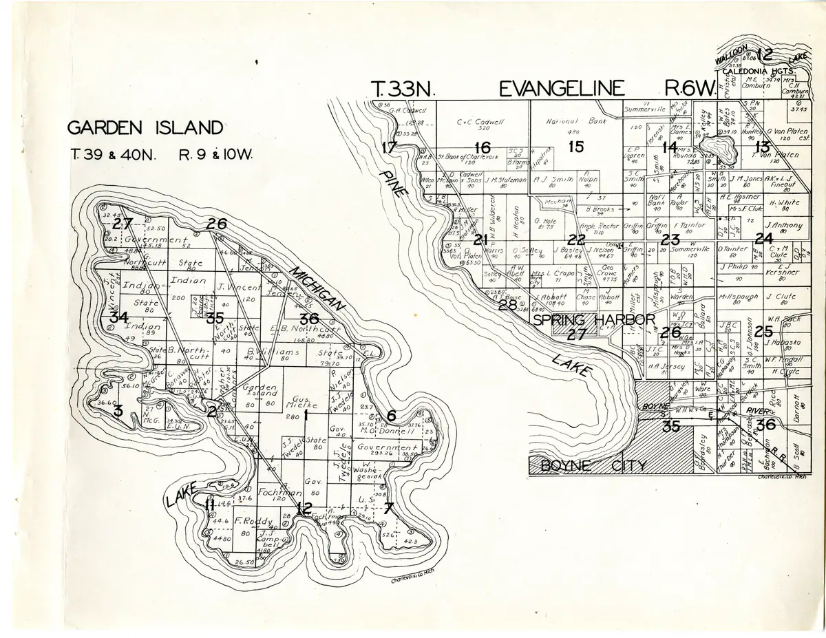
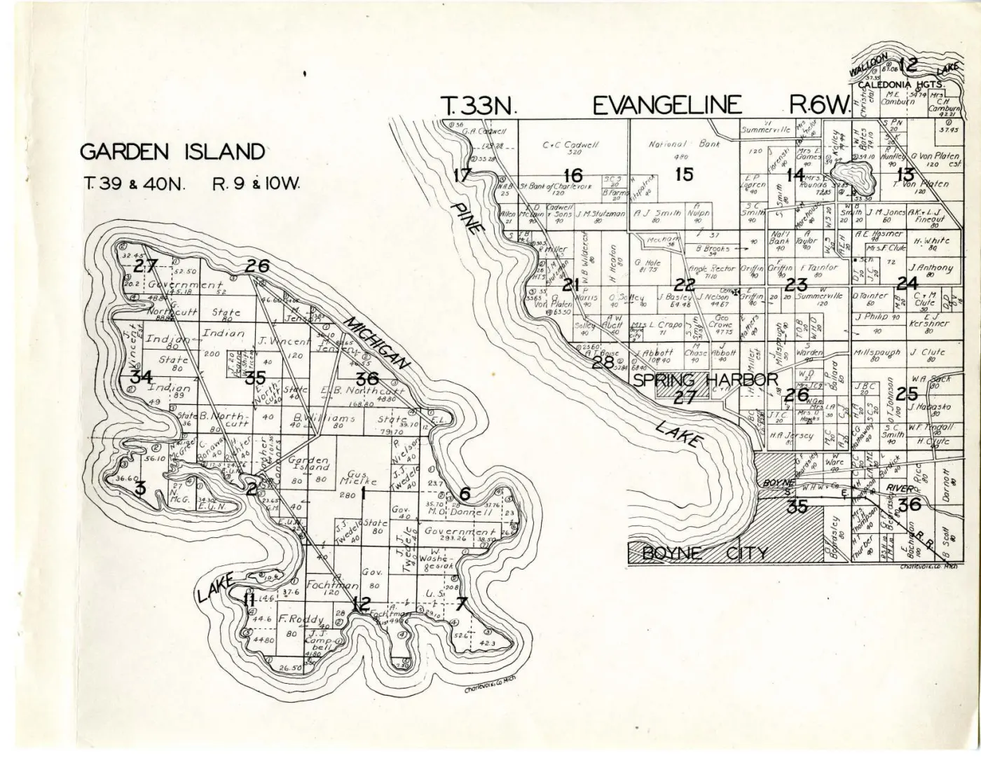
Garden Island drawn to name the owner and acreage of every parcel, under the heading
GARDEN ISLAND T. 39 & 40N. R. 9 & 10W.
It fills the left half of its leaf. The right half is T.33N. Evangeline R.6W., a mainland township around Boyne City and Walloon Lake, and the two have nothing to do with each other: they share the paper because a plat book fills its pages. This article is about the island half.
This sheet was nearly missed. The repository’s catalogue lists the archipelago sheets by canvas number, and read as PDF page numbers those land two pages short; page 17 of the volume PDF was taken at first glance for an Evangeline sheet alone, because Evangeline is the half whose heading sits at the top of the leaf. Garden Island is on it, headed at the left.
Ownership, as the compilers recorded it
Four parcels are marked only Indian — 80 acres in section 34, 200 and 80 in
section 35, and 89 and 49 in section 34 — exactly as the 1901 edition marked a
large number of parcels on this island and on High Island. Thirty years on, this
volume repeats the practice. It is the compilers’ label and not a name; the
unnamed parcels are a defect in the source, not an absence of people, and the
archive’s other holdings for this island should be read alongside it rather than
against it.
The named holdings, read round the sheet (spellings verbatim):
Governmenton the largest blocks — 145.18 and 52 in section 27, 293.26 in the south-east, and further shore parcels of 32.45, 52.50, 20.2 and 48.80.Stateon 80-acre blocks in sections 27, 34, 35, 36 and 6, and on a 36 and a 40.- Northcutt, the commonest private surname on the island —
G. Northcutt88.8,E. Northcutt40,B. Northcutt80 andE. B. Northcutt168.80 and 48.80. - North and east —
J. Vincent Est.,J. Vincent120,M. Jenson13.83, 36.10, 82.65 and 46.55,B. Williams80 and 40,E. L.12. - South and centre —
Gus. Mielke280,P. Nielson40,J. J. Twedele40 on three parcels,M. O'Donnell23.7 and 28,Fochtman120,F. Roddy40,J. J. Campbell44.80,W. Washegesiak,N. McGreenandN. McG.56.10, 36.60, 34.30 and 41.10,C. Bonaway40,H. Richter40,Connors,G. M.23.65, and a small parcel letteredGarden Islanditself. - Three parcels are lettered only
E. U. N., which is not expanded anywhere on the sheet.
Washegesiak, Bonaway and McGreen are Anishinaabe surnames on an island
whose Anishinaabe community this archive documents elsewhere, and they sit beside
the four parcels the compilers would not name.
What is drawn, and what is not
Long double-cased lines run diagonally across the island from the north-west shore to the south-east — three of them, converging near the harbour at the east side of section 2. In the volume’s own terms they are undefined: this atlas prints no legend, no scale statement and no date.
The small hooked mark drawn like a figure 6 recurs beside parcel labels here too, and short arrows point from a name into the adjoining parcel; neither is explained. Acreages above are given as drawn.
Open questions
- What
E. U. N.stands for. It is used as an owner’s name on three parcels. - Whether the four
Indianparcels can be matched to named allottees from the federal records this archive holds for the island. - Whether the three diagonal double-cased lines are roads, trails or section ties. Nothing on the sheet says, and it has not been georeferenced.
See also
Sources
- W. W. Hixson & Company, “Garden Island T.39 & 40N. R.9 & 10W.”, in Plat Book
of Charlevoix Co. Mich. (Rockford, Ill., between 1930 and 1939). Read at
native resolution from the 6,600 x 5,100 px sheet master held at the
local_pathabove; Michigan State University Digital Repository item 961, ARKark:/85335/m56q1xj4p. kb/articles/documents/charlevoix-county-plat-book-1901.mdfor the 1901 plate’s treatment of the same island.
Read the document
19 pages, rendered from the held scan.
Sources
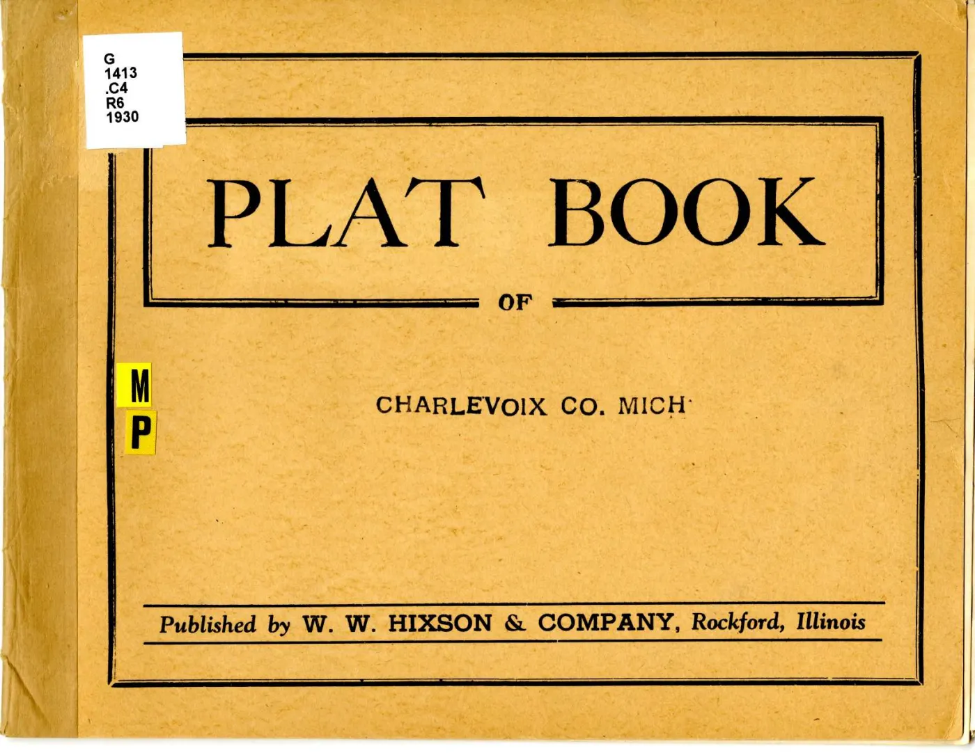
- Described in this archive: Plat book of Charlevoix County, Michigan, 1930s.The sheet master at 6,600 x 5,100 px, fetched from the holder's own IIIF Image service at the largest size it serves. Canvas 15 of 16 in the atlas manifest and page 17 of the volume PDF; the atlas prints no leaf numbers. Garden Island occupies the left half of the leaf and the mainland township of Evangeline the right.historical_maps · charlevoix_county_plat_book_1930s · garden-island-plat-1930s · garden-island-plat-1930s
- Described in this archive: Plat book of Charlevoix County, Michigan, 1930s.Michigan State University Digital Repository item 946. Source for the publication statement and for the date range, which is a range and not a year.historical_maps · charlevoix_county_plat_book_1930s · charlevoix-county-plat-book-1930s
Cite this article
Beaver Island Archive, “Plat of Garden Island, 1930s”, https://beaverislandarchive.org/documents/garden-island-plat-1930s/, accessed [date], citing W. W. Hixson & Company, "Garden Island T.39 & 40N. R.9 & 10W.", printed with "T.33N. Evangeline R.6W." on the same leaf, in *Plat Book of Charlevoix Co. Mich.* (Rockford, Ill., between 1930 and 1939). (and 1 further source listed on the page).
BibTeX for “Plat of Garden Island, 1930s”RIS for “Plat of Garden Island, 1930s”