

- Date
- 1866
- Eras
- Irish era
- Concepts
- toponymyland-surveyheritage
- Within
- Beaver Island archipelago
Summary
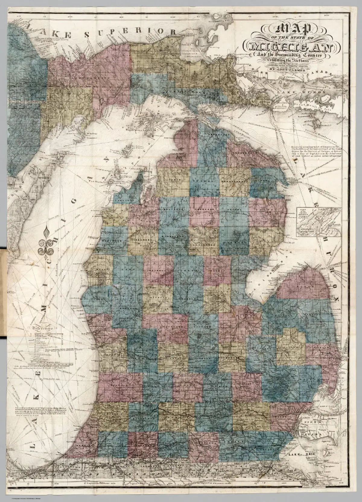

John Farmer’s held 1866 Michigan map provides a post-kingdom cartographic attestation for the persistence of several earlier Beaver Island labels. It is particularly useful when read beside the 1853 Farmer map and the 1854–55 U.S. Lake Survey chart.
Evidence and limits
The 1866 edition shows what this mapmaker printed a decade after the Kingdom of Saint James ended. It does not establish that any label remained in local use, identify its precise date of origin, prove a modern geographic match, or show political, legal, or demographic continuity.
See also
Sources
- Held scan and provenance identify the 1866 map and record its retention of Strang-era Beaver Island labels a decade after the Kingdom of Saint James fell. It establishes a later cartographic attestation only; it does not show that the labels persisted in local speech, establish a modern feature join, or document any legal or settlement condition.maps · rumsey · farmer_1866_michigan · full
- Project provenance sidecar for John Farmer 1866 Michigan map.Records the Rumsey IIIF source URL, retrieval date, checksum, file size, and CC BY-NC-SA 3.0 license for the held derivative. No public copy of this file is known; the archive holds one and can provide it on request.maps · rumsey · farmer_1866_michigan · full.provenance
Added 2 August 2026 · revised 4 August 2026. Recent changes
Cite this article
Beaver Island Archive, “John Farmer map of Michigan, 1866”, https://beaverislandarchive.org/documents/john-farmer-map-of-michigan-1866/, accessed [date], citing John Farmer, *Map of the State of Michigan and the Surrounding Country*, 23rd ed. (1866), David Rumsey Map Collection. (and 1 further source listed on the page).
Last revised 2026-08-04. Fill in [date] with the date you read it — this page is static and cannot know that.
BibTeX for “John Farmer map of Michigan, 1866”RIS for “John Farmer map of Michigan, 1866”