

- Along road
- East Side Drive
- Coordinates
- 45.5951° N, 85.5274° WGoogle Maps: Lake Geneserath Public AccessDownload KML
- Eras
- Modern era
- Concepts
- transportationrecreationconservation
- Within
- Beaver Island
Summary
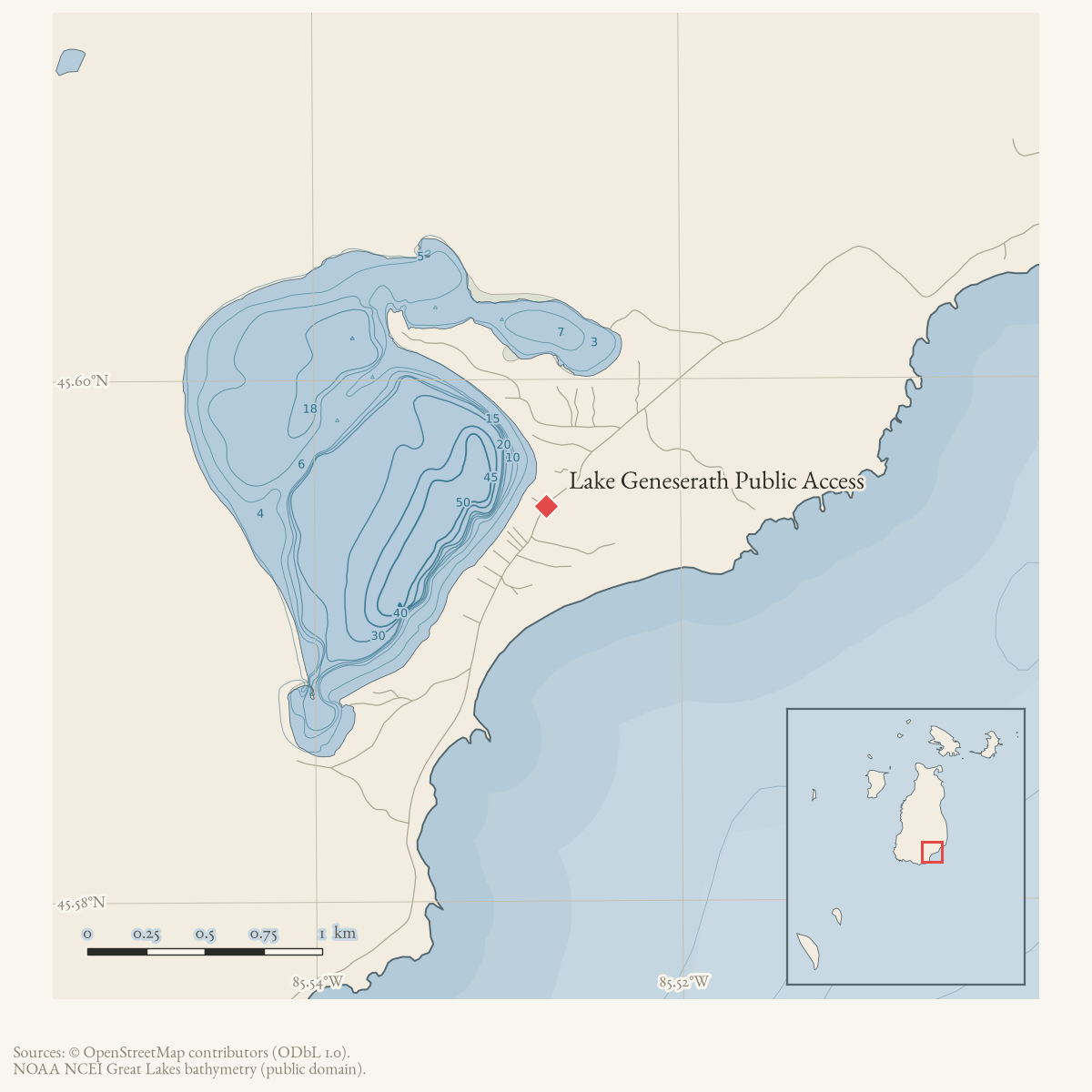
Lake Geneserath Public Access is a public boat-launch and recreation site listed in the Beaver Island recreation-facilities inventory. The inventory places it off East Side Drive at the south end of the island and describes an outhouse and trail as well as the lake access. A later DNR–Peaine lease names Lake Geneserath Boat Access & Campground among the leased sites.
Evidence and limits
The sources establish a road-linked access designation, not a surveyed facility boundary, easement, construction history, or current condition. A 2020 forum discussion adds a qualified report of a hand pump at a Peaine Township park on East Side Drive, but does not prove that it belongs to this access site or that the water is potable.
Open questions
- What parcel and access record define the site?
- Does the current DNR–Peaine lease still govern it?
- Can a current map resolve its point or polygon geometry?
Maps for this place
These Atlas plates provide regional context. They do not establish a precise boundary, current ownership, access right, operating status, or field condition.
- EnvironmentSoils, wetlands, hydrography, and terrain
- GeologyGeneralized geology and landforms
- HydrologyMapped water and wetland context
- AccessMapped routes, facilities, and protected areas
- Land surveyPLSS geometry and historic GLO patent-location context
The dated record
Sources
- A Peaine Township notice said onsite boat storage was not permitted at the public access sites on Lake Geneserath and Fox Lake and asked users to remove boats before Memorial Day. This is a first-party seasonal rule notice, not a parcel, easement, or current-condition record.forum · www.beaverislandforum.com · 13 · t013061
- A participant identified a hand pump at the Peaine Township park on East Side Drive as a water source. The thread does not formally identify the park as this Lake Geneserath access site, establish the pump’s exact location or condition, or certify the water as potable; it is retained as a qualified location clue.forum · www.beaverislandforum.com · 15 · t015448
- Nearest East Side Drive-to-water point used as an approximate access proxy because the recreation inventory places the launch off East Side Drive; it is not a surveyed access parcel or launch footprint.osm · roads
- The inventory lists Lake Geneserath Public Access off East Side Drive at the south end of the island, with a public boat launch, large fishing lake, outhouse, and trail. It does not establish a parcel boundary, exact access point, easement, construction date, or current condition.planning · beaver_island_master_plan · 2017-beaver-island-resilient-master-plan-8cbeebcd
- Names Lake Geneserath Boat Access & Campground among five DNR-leased Peaine public-recreation sites; it does not independently resolve the access geometry or current condition.research · island_governance · peaine-lake-geneserath-dnr-lease
Added 2 August 2026. Recent changes
Cite this article
Beaver Island Archive, “Lake Geneserath Public Access”, https://beaverislandarchive.org/places/lake-geneserath-public-access/, accessed [date], citing Peaine Township, “Lake Geneserath & Fox Lake accss sites,” Beaver Island Forum, May 11, 2018. (and 4 further sources listed on the page).
Last revised 2026-08-02. Fill in [date] with the date you read it — this page is static and cannot know that.
BibTeX for “Lake Geneserath Public Access”RIS for “Lake Geneserath Public Access”