

- Coordinates
- 45.7272° N, 85.5726° WGoogle Maps: McCauley PointDownload KML
- Eras
- Modern era
- Concepts
- toponymyfishingmaritimetourismenvironmentgeologysoilsdunesvegetationplantstreeswildlifeanimalsconservationstewardshipinvasive-species
- Within
- Beaver Island
- Media
- Beaver Island History Map, 1978 revision
Summary
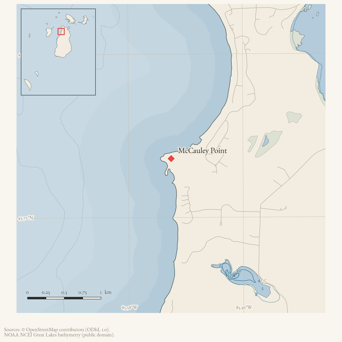
McCauley Point is a GNIS-named cape on Beaver Island. The 2023 Beaver Island Master Plan lists “McCauley’s Point” among its water-trail access sites, and a November 2025 Northern Islander map labels it among the island’s Dark Sky viewing sites. These current maps establish continued geographic use of the name and a recreational/coastal-access context; they do not yet establish the history of any access facility. Helen Collar’s notes say Owen F. McCauley fished there with pound nets; the fuller biographical entry explicitly says the point was named for him. It does not date the naming or the fishing.
The 1978 Historical Map calls the namesake “Big Owen” McCauley. Collar’s files make that wording unlikely: Owen F. McCauley’s wife Catherine Gallagher was the sister of Owen “Big Owen” Gallagher. The map therefore appears to have transferred the brother-in-law’s nickname to Owen F. McCauley. This is recorded as a probable conflation, not silently normalized.
Ecological profile
MNFI Report 2017-11 records a 30-acre open-dune occurrence at McCauley Point (EO 20737, rank C, G3/S3; p. 114), a low parabolic dune and low foredune on Beaver Island’s northwestern shore. Fine-textured wind-blown and wave-worked sands are alkaline around pH 8.0. Marram grass and sand reed grass dominate; wormwood, milkweed, Pitcher’s thistle, beach pea, Gillman’s goldenrod, plains puccoon, wheat grass, white camas, harebell, June grass, and little bluestem are also recorded.
Bearberry, common and creeping juniper, sand cherry, soapberry, snowberry, and silky dogwood form a 30–50 percent shrub layer. Scattered trees include balsam poplar, cedar, paper birch, blue-leaf willow, white pine, and balsam fir. A blowout contains ancient cedar snags, evidence that the active dune occupies a formerly forested dune. Residential development, foot-traffic erosion, and devegetation are the primary threats; spotted knapweed, Canada bluegrass, and bladder campion are locally common. MNFI recommends limiting human traffic and monitoring invasive species. This occurrence is not a current legal boundary, property determination, complete plant or wildlife inventory, or present- condition assessment.
Open questions
- When was McCauley Point first named for Owen F. McCauley, and what deed, chart, or oral-history record first used the name?
- What access facilities, if any, have existed there and on what dates?
Sources
- GNIS feature 631824; feature class 'Cape'.federal · gnis · gnis_names
- Lists “McCauley's Point” as a coastal access site.
- Northern Islander, November 2025, Beaver Island Dark Sky Sanctuary map.The published map labels McCauley's Point among Beaver Island viewing sites; the map is a present-day geographic reference, not a history of the point. No public copy of this file is known; the archive holds one and can provide it on request.
- The place-name card says Owen McCauley fished at McCauley Point with pond nets. Read together with Collar’s Owen F. McCauley biographical entry, it identifies the fisherman and namesake, though it does not date the fishing.web · collar_subject_cards_q-z
- States that McCauley Point was named for Owen F. McCauley and that he fished off it with pound nets. The same entry identifies his wife Catherine Gallagher as the sister of “Big Owen,” showing that Big Owen was Gallagher, not McCauley.web · collar_biographical_biographical-papers-h-m
- Described in this archive: Beaver Island History Map, 1978 revision.Says the point was named for “Big Owen” McCauley. Collar’s biographical files instead distinguish namesake Owen F. McCauley from his brother-in-law Owen “Big Owen” Gallagher; the map wording is treated as a probable conflation.
- Project-generated MNFI 2017 soil, vegetation, and wildlife crosswalk, preserving MNFI Report 2017-11, McCauley Point open dunes occurrence (EO 20737), report p. 114.Described in this archive: MNFI soil, vegetation, tree, and wildlife crosswalk, 2017.The 30-acre record is a source-defined open-dune occurrence along McCauley Point; it is not a current legal boundary, ownership determination, or complete survey. No public copy of this file is known; the archive holds one and can provide it on request.research · island_farming · crosswalks · mnfi_soil_vegetation_wildlife_crosswalk
- Visual page evidence held with provenance sidecar; the image anchors the occurrence description and does not establish modern geometry or current condition.research · island_farming · evidence · mnfi-report-2017-11-page-0114-mccauley-point-open-dunes
Added 28 July 2026 · revised 7 August 2026. Recent changes
Cite this article
Beaver Island Archive, “McCauley Point”, https://beaverislandarchive.org/places/mccauley-point/, accessed [date], citing U.S. Geological Survey, Geographic Names Information System, Domestic Names (Michigan), retrieved 2026-07-28. (and 7 further sources listed on the page).
Last revised 2026-08-07. Fill in [date] with the date you read it — this page is static and cannot know that.