

- Date
- 1965
- Eras
- Modern era
- Concepts
- cartographytransportationtourismmaritimetoponymy
- Within
- Beaver Island
Summary
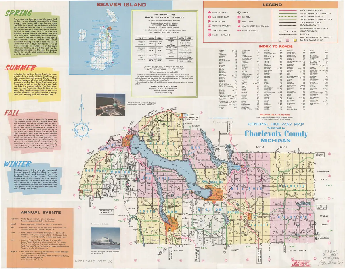
A folded county highway brochure published for the 1965 season, at approximately 1:125,000, with roads as its actual subject — which makes it a different instrument from the cadastral plat books either side of it. Where a plat book draws a line and leaves it undefined, this sheet classifies every road it draws against a printed legend of ten classes.
For this archive its value is concentrated in three things printed on the map face: a Beaver Island inset covering the whole archipelago, a short list headed “BEAVER ISLAND ROADS” naming eight island roads, and the 1965 Beaver Island Boat Company sailing schedule with its fares and its manager’s name.
It also sits in a gap. The archive’s cadastral coverage of island roads runs 1901, then the 1930s plat books, then modern data. Nothing between the Second World War and the present described the island’s road network until this sheet.
The legend, which is the point
Ten line classes, transcribed from the panel:
STATE & FEDERAL HIGHWAY · COUNTY PRIMARY ROAD—BLACKTOP · COUNTY PRIMARY—GRAVEL · COUNTY PRIMARY—TURNPIKED EARTH · LOCAL ROAD—BLACKTOP · LOCAL ROAD—GRAVEL · LOCAL ROAD—TURNPIKED EARTH · UNIMPROVED EARTH · RAILROAD · ROAD MAINTAINED BY ADJ. COUNTY
with symbols for public campsite, launching ramp, golf course, docking facilities, township park, beach, airport, ski area, fire tower, state forest campground and public fishing site.
A caution that governs everything read off the island inset. The legend belongs to the main county map, and the inset is drawn in its own blue line work. Only one island route is drawn in a legend colour — the green County Primary symbol. Every other island road is blue, in two weights, solid and dashed, and the legend does not say what the two blue weights mean. They are plainly a higher and a lower class of road; which legend rows they correspond to is not stated and is not assumed here.
What the Beaver Island inset shows
The inset covers Beaver, Garden and High islands with the township and section grid, and names the shore features. The road network on Beaver Island:
- One County Primary route, in green, and the only road on the island the
legend classifies. It leaves St. James at the harbour, runs south as
KINGS HIGHWAYthrough sections 34, 11, 14, 15, 22 and 23, and turns east to meet the shore atPT. LA PAR; a green spur loops west from it towardsEGG L.and the airport, and a second green length runs the east shore asEAST SHOREroad. The pairing is the same one the sheet’s own road list makes: Darkeytown—Hannigan—East Shore—Kings Highway. HANNIGAN RD., solid blue, running the full width of the island east–west along the T.38 N./T.39 N. line from the west side to Pt. La Par.- A dashed route south of Hannigan Road leaving the Fox Lake neighbourhood and running south through sections 33 and 4. It stops in the interior, around the section 4/9 line, well short of Lake Geneserath.
- The east shore, solid, continuing south from Pt. La Par past
Wicklow Beach and Martin’s Bluff to
KELTYS PT.andMcCAULEYS BAY, then west along the shore pastCABLE BAYto the outlet end ofL. GENESERATH. - The west side, dashed, as
WEST SIDE,REDDING RD.andFRENCH BAY RD., running south through sections 30, 31, 6, 7, 12, 13, 18 and 19 toIRONORE BAY. DARKEYTOWN RD.andFOX LAKE RD.in the north and centre, and short dashed spurs toBONNERS BLUFF,LEFT'S PT.and theAIRPORT.
What it says about a road south to Lake Geneserath
Stated as narrowly as the sheet allows, because this is a question the archive is actively working on and a map is easy to over-read.
There is a road running south into the interior past Hannigan Road, drawn at the inset’s lower class, from the Fox Lake neighbourhood through sections 33 and 4. It is drawn as ending in the interior and it does not reach Lake Geneserath. In 1965 the lake was reached instead from the east, by the shore road round Kelty’s Point and Cable Bay.
Two things the sheet does not support, and which should not be read into it:
- it does not draw a continuous north–south route from King’s Highway to Lake Geneserath, and the absence of one on a county highway map is evidence about what the county maintained, not proof that no track existed on the ground;
- no railroad symbol appears anywhere on Beaver Island, although the legend carries one and the mainland uses it. The island’s logging railway had been gone for roughly half a century by 1965.
The named-road list is itself a dated statement of what the island’s roads were called in 1965: Darkeytown, Hannigan, East Shore, Kings Highway, Fox Lake, Redding, French Bay, West Side — eight names for an island that now carries far more, and two of them, Darkeytown and Sloptown, later became the subject of a township naming dispute recorded elsewhere in this archive.
The Boat Company schedule
Printed beside the inset and dating the sheet from its own contents:
1965 — SCHEDULE — 1965 / BEAVER ISLAND BOAT COMPANY ST. JAMES on Historic Beaver Island MICHIGAN Charlevoix – Beaver Island Ferry Schedule MOTOR SHIP BEAVER ISLANDER Schedule for 1965 Season, Weather Permitting
with sailings from late April to December, a fare table — “ADULTS — One Way $3.00 · CHILDREN — One Way $1.50 · Round Trip, Valid for 1965 Season, Non-redeemable $5.50 · Car and Driver — One Way $10.00” — a freight and baggage clause, a 30-minute reservation-release rule, and the line “Charlevoix City Dock — Phone Liberty 7-2311 / James W. Gallagher, Manager”.
That is a dated operating record for Beaver Island Boat Company printed on a map, which is an unusual place to find one.
Toponymy
Read off the inset: DONNEGAL BAY — spelled with two Ns —
LUNEYS PT., LITTLE SANDY BAY, CONN'S PT., SAND BAY, PT. LA PAR,
WICKLOW BEACH, MARTINS BLUFF, KELTYS PT., McCAULEYS BAY, CABLE BAY,
L. GENESERATH, IRONORE BAY, FRENCHS BAY, GREEN BAY, GREEN LAKE,
FOX LAKE, BARNEY L., EGG L., ROUND L., FONT L., BONNERS BLUFF,
LEFT'S PT., OLIVER PT., INDIAN PT.
KELTYS PT. again — the third dated attestation this archive holds of the Kelty
spelling against the GNIS form Kilty, after the 1901 and the 1930s plat sheets.
CABLE BAY is again spelled with a C, and again drawn on the south-east shore.
Open questions
- What the inset’s two blue line weights correspond to in the legend. Without that, the class of every island road except the green route is unknown.
- Where the dashed interior route south of Hannigan Road actually ended on the ground, and whether it is the same alignment as the double-cased road on the 1930s plat sheet. Needs georeferencing.
- Whether the county issued this brochure in other years. A 1963 or a 1967 sheet would turn one road snapshot into a series.
See also
Sources
- General Highway Map, Charlevoix County, Michigan (1965), recto and verso.
Michigan State University Digital Repository item 1030,
ARK
ark:/85335/m5d21vg67; MSU call number G4113.C4P2 1965 C4. Read at native resolution from the sheet masters held at thelocal_pathvalues above. - The sheet’s own legend, road index, “Beaver Island Roads” list and Beaver Island Boat Company schedule, transcribed above.
Sources
- The map face, 9,553 x 7,447 px, from the holder's IIIF Image service. Carries the county map, the legend, the index to roads, the Beaver Island inset, the "Beaver Island Roads" list and the 1965 Beaver Island Boat Company schedule.historical_maps · msu_charlevoix_plats · charlevoix-county-highway-map-1965-recto
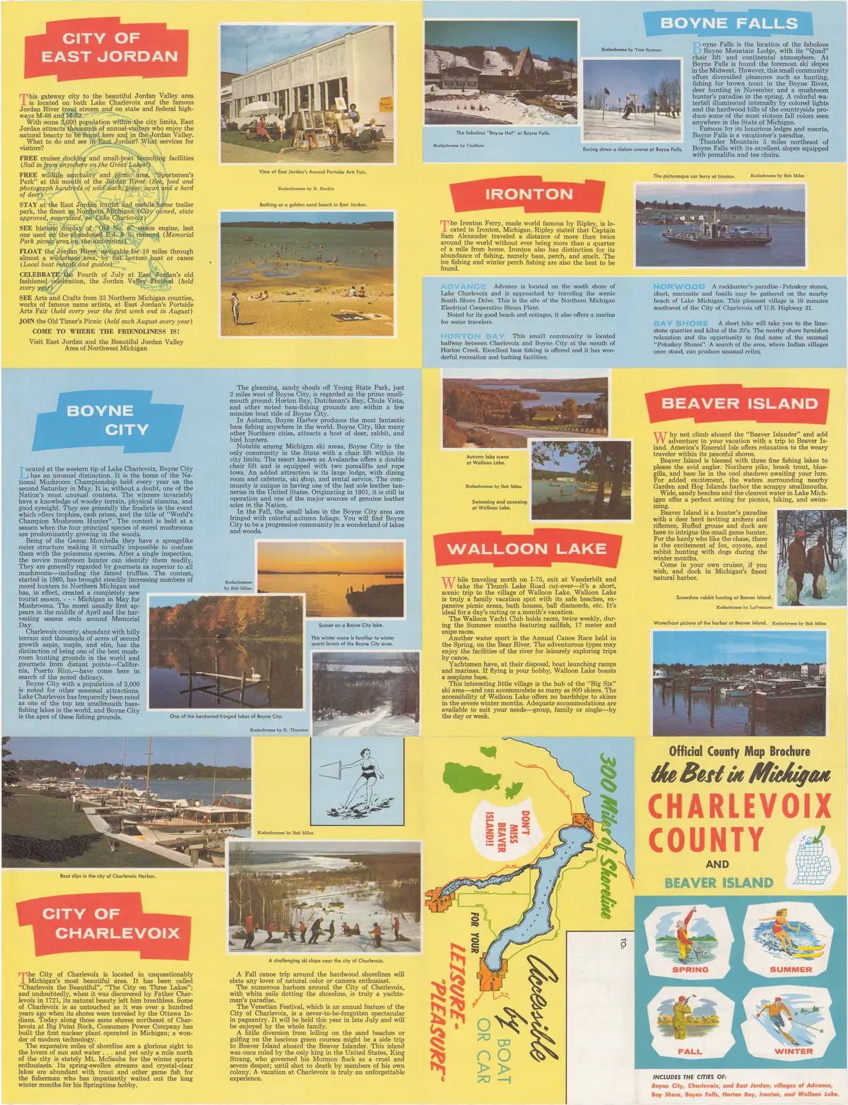
- The reverse of the folded brochure. Seasonal promotional copy and an annual events calendar; no map of the archipelago.historical_maps · msu_charlevoix_plats · charlevoix-county-highway-map-1965-verso
- The catalogue record. Unlike the plat books, this one is dated to a single year, and the sheet dates itself in its own schedule.
Cite this article
Beaver Island Archive, “General highway map of Charlevoix County, 1965”, https://beaverislandarchive.org/documents/charlevoix-county-general-highway-map-1965/, accessed [date], citing *General Highway Map, Charlevoix County, Michigan* (Charlevoix County, Mich., 1965), recto. Michigan State University call number G4113.C4P2 1965 C4, read from the sheet itself. (and 2 further sources listed on the page).
BibTeX for “General highway map of Charlevoix County, 1965”RIS for “General highway map of Charlevoix County, 1965”