

- Coordinates
- 45.5950° N, 85.5159° WGoogle Maps: Cable's CreekDownload KML
- Eras
- Modern era
- Concepts
- environmentfishingconservation
- Within
- Beaver Island
- Media
- Beaver Island History Map, 1978 revision
Summary
Cable’s Creek is the stream described by the Michigan Department of Natural Resources as flowing from the east side of Lake Geneserath eastward to Cable Bay on Beaver Island. Its 2017 plan describes sandy soils, limited groundwater contribution, and reaches that can dry in late summer when the water table is low. The plan calls it a Type 1 designated trout stream and reports naturally reproducing brook trout and rainbow trout (steelhead), along with several listed warm-water species.
The creek also connects the inland lake to a documented local conservation intervention: a May 1965 newspaper reported that Beaver Island Game Club volunteers put sandbags at a Cables Creek culvert to retain water for pike spawning. A separate 2019–2048 DNR lease names a “Cables Creek Beach Access,” but does not define the stream corridor or access boundaries.
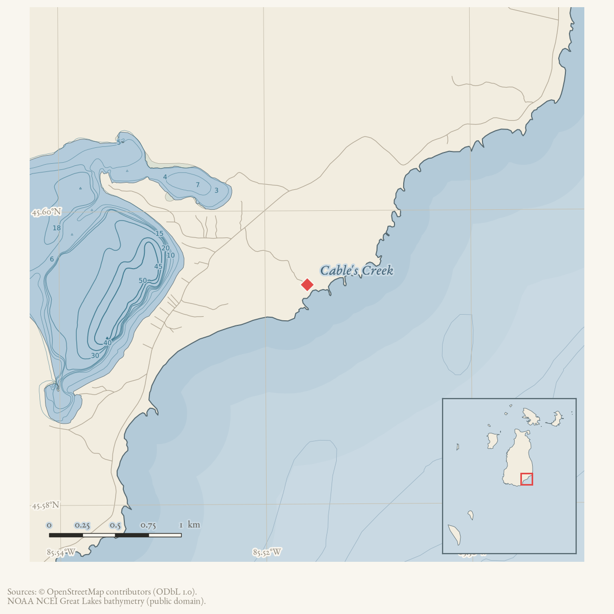
The map point is the approximate end of the named Cable’s Creek Road at that access setting. It makes the record useful for finding the documented access area while preserving the unresolved status of the creek’s actual geometry.
Scope and limits
This entry does not assign a mapped channel or stream centroid because the held sources do not provide a checked creek geometry. The DNR description is a dated management and fisheries account, not a continuous flow gauge, complete species inventory, current condition report, access authorization, or ownership record. The 1965 newspaper report establishes the reported sandbag work, not a permanent dam or demonstrated fisheries outcome.
See also
Sources
- Described in this archive: MDNR management plan for state-owned Northern Lake Michigan islands, 2017.The plan says Cable’s Creek flows from the east side of Lake Geneserath eastward to Cable Bay in Lake Michigan. It describes sandy soils, low groundwater contribution, late-summer drying in low-water-table periods, naturally reproducing brook trout and rainbow trout (steelhead), listed warm-water species, and Type 1 designated-trout-stream status. This is a 2017 management description, not a surveyed current channel, flow record, access determination, or complete fisheries inventory.research · island_farming · sources · mdnr_northern_lake_michigan_islands_plan_2017
- Described in this archive: Beaver Island Game Club dams Cables Creek for pike habitat.Reports a temporary 1965 sandbag intervention at the Cables Creek culvert to hold water for pike spawning from Lake Geneserath. It does not locate the culvert precisely, establish a permanent structure, or measure biological results.data1 · beaver-island-archive · beaver_beacon · 1965-05_Beaver-Beacon
- The held eight-page issue scan is paired with the OCR source and confirms the published notice or report; it does not expand the source-specific identity, event, or outcome claims.data1 · beaver-island-archive · scans · beaver_beacon · issues · 1965-05_Beaver-Beacon
- Described in this archive: DNR–Peaine Township public-recreation lease, 2019–2048.Names “Cables Creek Beach Access” among leased public-recreation sites. The name supports an access-site connection only; it does not establish the creek’s legal boundary, public-access extent, or current condition.government · peaine · dnr_peaine_recreation_lease_2019
- Project-generated named stream crosswalk (2026).Checked exact target-name matches in the held GNIS, NHD flowline, and OSM waterway snapshots; none supplied a Cable’s Creek/Cables Creek line geometry. The crosswalk therefore retains the DNR and newspaper narrative without drawing an inferred channel. No public copy of this file is known; the archive holds one and can provide it on request.research · places · archipelago_stream_crosswalk
- The named Cable's Creek Road line ends at approximately longitude -85.515936, latitude 45.594963, within the access setting also named by the DNR lease. That endpoint is used as an approximate public-access locator only; it is not asserted as the creek mouth, channel centerline, or stream centroid.osm · roads
Added 2 August 2026 · revised 6 August 2026. Recent changes
Cite this article
Beaver Island Archive, “Cable's Creek”, https://beaverislandarchive.org/places/cable-s-creek/, accessed [date], citing Michigan Department of Natural Resources, *Management Plan for State-owned Lands on Northern Lake Michigan Islands* (February 2017), pp. 17–18. (and 5 further sources listed on the page).
Last revised 2026-08-06. Fill in [date] with the date you read it — this page is static and cannot know that.