

- Coordinates
- 45.5792° N, 85.6067° WGoogle Maps: Cheyenne PointDownload KML
- Eras
- Modern era
- Concepts
- environmenttourismmaritime
- Within
- Beaver Island
- Media
- Beaver Island History Map, 1978 revision · Plat of Big Beaver Island, 1901 · Plat of the south end of Beaver Island, 1930s
Summary
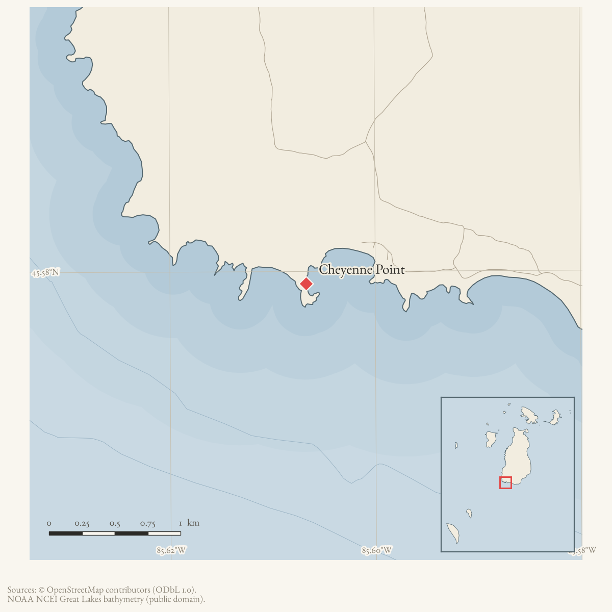
Cheyenne Point is a GNIS-named cape at the south end of Beaver Island. A February 1969 winter account describes a snowmobile caravan traveling from the Lake Geneserath area around Iron Ore Bay to Cheyenne Point. The writer noted large numbers of deer, a visible browse line in the cedars, and cedar trees and mineral blocks used during the outing. This is evidence of contemporary winter recreation and observations of the landscape, not a wildlife-management survey.
A May 1973 local story recounts a beachcombing trip in which a vehicle became stuck near Cheyenne Point. A Coast Guard helicopter reportedly landed on the beach after seeing the party’s signals and helped arrange their return. Because the item is an anecdotal newspaper feature, it does not establish a permanent road, public access route, or Coast Guard facility at the point.
A Helen Collar research card independently records that local informants did not know the name’s origin. It preserves a speculative explanation connecting the name with island men who worked on western railroad construction. The account is useful evidence for the history of local explanation, but does not settle the toponymy.
The 1978 History Map states the connection more strongly, saying fishermen who camped here had worked on the transcontinental railroad. No worker name, railroad company, payroll, or camp record was found in this review. Because Collar’s related note says the origin was unknown and labels the railroad idea as speculation, the map wording is retained as an attributed elaboration, not an established etymology.
Open questions
- What historic maps or land records define access to the point and its relation to Iron Ore Bay?
- Is the name Cheyenne Point explained in local, Indigenous, or land-record sources beyond the speculative railroad-worker explanation preserved in the research card?
- Can the 1973 beach location be identified without treating the anecdote as a formal navigation or rescue record?
Sources
- Participants asked about the name Cheyenne Point, discussed the nearby Gull Harbor crossing colloquially called the “Free Car Wash,” and recalled that the road had been dry for at least several years by 2005. These are community recollections and do not establish the name origin, a surveyed road alignment, or a safe/public vehicle crossing.forum · www.beaverislandforum.com · 00 · t000470
- GNIS feature 623177; feature class 'Cape'.federal · gnis · gnis_names
- Describes a winter snowmobile excursion from Lake Geneserath around Iron Ore Bay to Cheyenne Point, with observations of deer, cedar browse, and mineral blocks placed for wildlife.data1 · beaver-island-archive · beaver_beacon · 1969-02_Beaver-Beacon
- The held six-page issue scan is paired with the OCR source and confirms the published notice or report; it does not expand the source-specific identity, event, or outcome claims.data1 · beaver-island-archive · scans · beaver_beacon · issues · 1969-02_Beaver-Beacon
- A humorous local account says a vehicle became stuck near Cheyenne Point during beachcombing and that a Coast Guard helicopter landed on the beach to assist; the anecdote is not treated as proof of a formal road or landing facility.data1 · beaver-island-archive · beaver_beacon · 1973-05_Beaver-Beacon
- The held nine-page issue scan is paired with the OCR source and confirms the published notice or report; it does not expand the source-specific identity, event, or outcome claims.data1 · beaver-island-archive · scans · beaver_beacon · issues · 1973-05_Beaver-Beacon
- The local research card says no one seemed to know the origin of Cheyenne Point and preserves Lawrence's speculation that the name may have come from island men who worked on western railroads. This is explicitly an unresolved oral/local explanation, not an established etymology.web · collar_subject_cards_q-z
- Described in this archive: Beaver Island History Map, 1978 revision.Converts the railroad explanation into a statement about fishermen camping at the point who had worked on the transcontinental railroad. No names, railroad, payroll, or camp record was found; Collar's underlying card presents the explanation only as speculation.
Added 28 July 2026 · revised 7 August 2026. Recent changes
Cite this article
Beaver Island Archive, “Cheyenne Point”, https://beaverislandarchive.org/places/cheyenne-point/, accessed [date], citing Anna, Sean, and Trish Scott, “Cheyenne Point,” Beaver Island Forum, October 12–18, 2005. (and 7 further sources listed on the page).
Last revised 2026-08-07. Fill in [date] with the date you read it — this page is static and cannot know that.