

- Dates
- 1948 – 2024
- Eras
- Modern era
- Concepts
- wildlifebirdsanimalsenvironmentconservationforestswetlandsgovernanceheritage
- Within
- Beaver Island archipelago
Summary
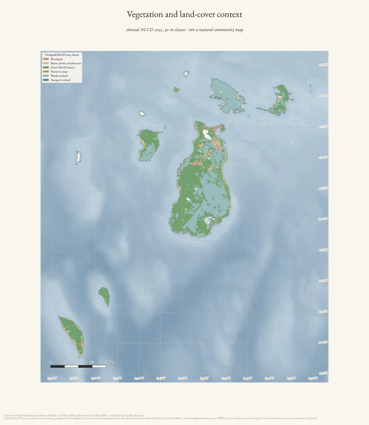
This index connects the archipelago’s strongest held wildlife and bird evidence across the seven-island state-management frame: Beaver, Garden, High, Hog, Whiskey, North Fox, and South Fox. It is the species-level companion to the land-cover, tree-canopy, soils, geology, wetlands, and MNFI natural-community layers.
The central finding is that the outer islands are not merely habitat proxies. The 2017 MDNR plan records species or species groups on High, South Fox, North Fox, Garden, Hog, and Whiskey, including Piping Plovers, Bald Eagles, terns, and other rare species. It also records direct wildlife studies and managed introductions: ruffed-grouse releases on High, Garden, and Hog; woodcock research on High; and historical deer status on South Fox. The 2024 MNFI guide adds a site-specific 2023 High Island Piping Plover nesting outcome. The current DNR nesting-area order continues to name portions of High, Beaver, and South Fox islands for protection, connecting the historical record to an active public-management framework. The Whiskey Island cormorant crosswalk adds a direct 2010 colony study, diet and prey-consumption modeling, and a clear distinction between direct field evidence and the 2017 plan’s table-level distribution marks. MNFI’s 2019 invasive-action framework adds the regional connection between shoreline vegetation, Phragmites management, and colonial waterbird habitat, while preserving the limitation that its 92-percent island waterbird figure is not a current Beaver Archipelago count. The companion 2017 GEI survey crosswalk adds the finer shoreline/dune management layer: its held downstream accounts describe survey scale and treatment priorities, but do not provide invasive-treatment polygons that can be mistaken for bird habitat boundaries. The newly held Powell-Cuthbert study supersedes the earlier bibliography abstract for the 1987–1990 Piping Plover work: it supplies direct search methods, named Beaver and High Island nest sites, beach/dune measurements, foredune vegetation, ephemeral-pool use, and yearly reproductive outcomes. The USGS Data Series 922 appendix extends that chronology to a standardized June 2011 census: six named Charlevoix County shore segments on Beaver and High recorded zero pairs and zero adults, while prior census-year flags remain visible for several segments. The High Island footnote preserves uncertainty about assigning a 2006 pair between the NW Side and NE Spit. Because the targeted appendix does not list Fox, Garden, Hog, Whiskey, or every other archipelago island, it is a site-level monitoring bridge rather than an archipelago-wide negative survey. The older MNFI bibliography adds a 1987 ten-island Piping Plover survey: High Island nested successfully, while Beaver and South Fox had suitable habitat but no nesting was reported on the other surveyed islands. It also records the 1948 archipelago vertebrate study and explicitly identifies Hog Island as an inventory gap in 1993. For the Fox Islands specifically, the same bibliography summarizes a 1990 North Fox vegetation assessment as mature-to-overmature, essentially recovered forest with three exemplary natural-community occurrences, while describing South Fox community inventory as less thorough. MNFI Report 2019-13 adds the formal survey-prioritization layer: three known North Fox EOs, four known South Fox EOs, old survey dates, candidate open-dune/beach/barrens/wetland targets, and the explicit rationale for later wall-to-wall and field-survey work.
Evidence by island
The counts below are counts of linked evidence records, not species richness. Records can contain more than one taxon, and the absence of a record does not mean absence of the species.
| Island | What the connected record set contains |
|---|---|
| Beaver | Deer, ruffed grouse, Piping Plover, Bald Eagle, Common Loon, Common Moorhen, colonial waterbirds, migratory birds, and the broader MNFI rare-animal list |
| Garden | Deer, ruffed grouse, Piping Plover distribution context, Bald Eagle, Common and Caspian Terns, grouse management work, and hunting reports |
| High | Ruffed grouse, American Woodcock research, Piping Plover critical-habitat/nesting records, Bald Eagle, Common and Caspian Terns, colonial nesting, and the 2023 High Island Plover outcome |
| Hog | Ruffed-grouse releases and failure account, Bald Eagle, Common Tern, and historic hunting/regulation context |
| Whiskey | Bald Eagle and seven amphibian/reptile table marks in the MDNR plan, plus a direct 2010 Double-crested Cormorant colony study; the absence of held natural-heritage surveys and current public observations remains a coverage limit, not a biological conclusion |
| North Fox | Bald Eagle in the MDNR distribution table, three historical MNFI natural-community EOs and two 2019 candidate target polygons, plus current EGLE dune/forest evidence |
| South Fox | Deer, Piping Plover critical-habitat/nesting context, Bald Eagle, Peregrine Falcon, four historical MNFI natural-community EOs, seven 2019 candidate target polygons, and current EGLE dune/forest evidence |
Connected narrative records
The MDNR plan provides more ecological depth than a simple species list:
- Ruffed grouse: 68 birds were introduced to Beaver in 1948–49. Releases on High, Garden, and Hog in 1956–57 established grouse on High and Garden; the plan describes the Hog effort as unsuccessful, including another 28-bird release in 1961. Its 2017 status language calls grouse common on Beaver and High and less common on Garden.
- American Woodcock: a High Island study ran from 1968 through 1971 and examined exploitation, immigration, and the usefulness of singing-ground counts for tracking trends.
- Piping Plover: the plan identifies critical-habitat shoreline on Beaver, High, and South Fox and reports recent nesting pairs on High and South Fox. The MNFI guide reports seven High Island pairs in 2023, with eight chicks fledged in the wild and ten through captive rearing.
- Longer survey chronology: the 1987 survey summary in the 1993 MNFI bibliography documents the outer-island survey frame directly: High Island nesting, Beaver and South Fox suitable habitat, and non-nesting results for the other surveyed islands. Those results are not treated as current absence.
- Fox-Island forest baseline: the 1990 North Fox assessment is a rare direct vegetation/community source for an outer island. It should be joined to the current canopy and land-cover rasters, while the South Fox coverage statement should guide—not substitute for—a future field-survey search.
- Bird movement and colonies: the plan describes the northern Lake Michigan islands as migration stopovers and identifies Beaver, High, and South Fox Important Bird Areas. It also records 2007 colonial nesting activity on Beaver and High, while warning that activity varies with water levels and weather.
- Mammals and management: the plan’s 2017 account places deer on Beaver, Garden, and South Fox and says they were absent from High, Whiskey, Hog, and North Fox at that time. That is a dated management-plan statement, not a current survey.
How this joins the landscape layers
The evidence index should be read alongside the other ecological layers:
- NLCD and tree-canopy rasters describe current broad habitat structure for all seven islands.
- SSURGO and the 1974 soil survey provide soil and hydrologic context.
- MNFI 2017 natural-community records provide occurrence-level community observations, but only for Beaver, Garden, High, and Hog.
- The 1999 MNFI progress-report crosswalk adds standardized bird effort, aquatic sites, wetland/forest communities, and bounded Piping Plover and loon observations.
- The GBIF snapshot adds modern public human observations with record-level dates, publishers, licenses, coordinates, and coordinate-precision limits.
- This index adds species, wildlife research, protection, and historical management links, including the Fox Islands. The EGLE North Fox mapped-dune index adds current natural-community, forest, vegetation, dune-process, and habitat-function evidence for the previously thinly covered North Fox record. The companion South Fox index adds eight 2021-surveyed natural-community occurrences, rare-element counts, and detailed dune, wetland, forest, and bird-habitat evidence for the entire island-scale MDC 75. The Hog Island index adds current mesic-forest and limestone-cobble shoreline evidence, including tree ages, calcareous soils, and nearshore bird habitat.
That combination supports questions such as whether documented Piping Plover shorelines align with open beach and dune land cover, or whether grouse and woodcock records line up with forest/open-land mosaics. It does not support a claim that raster class, soil type, or an island-level habitat feature proves a species occurrence.
Limits and next work
The index mixes several evidence types by design, but labels them explicitly:
- an MDNR distribution-table mark is not the same as a field observation held at exact coordinates;
- a hunting regulation proves that a season or rule named an island, not that hunting occurred or that a population was abundant;
- a release documents management action, not survival or establishment;
- critical habitat and land-cover layers describe protection or habitat context, not a complete census;
- sensitive species locations should remain generalized unless the source is already public at that precision.
The next high-value expansion is to retrieve the cited bird and wildlife study reports (especially the 1987 Beaver Islands Piping Plover survey and the High Island woodcock study). The public-observation layer is now present, but it must remain separate from standardized survey evidence and should be refined with source date, effort, taxonomic confidence, and spatial precision. The new High Island woodcock crosswalk adds a secondary habitat synthesis while the original Whitcomb report remains a retrieval target.
Sources
See the sources: block above and the generated JSON index.
Sources
- Project-generated wildlife and habitat evidence index for the Beaver archipelago (2026).Uses this index as the linked habitat layer: 2017 MNFI occurrence excerpts, 2024 guide records, and island-scale environmental context remain separate from the existing wildlife records. No public copy of this file is known; the archive holds one and can provide it on request.research · wildlife · indices · wildlife_habitat_evidence_index
- The plan supplies narrative accounts of deer, ruffed grouse, woodcock, piping plovers, colonial nesters, and migratory birds, plus an island-distribution table. Its distribution table is based on records through Spring 2015 and is not a complete current inventory.research · island_farming · sources · mdnr_northern_lake_michigan_islands_plan_2017
- Reports 2023 High Island Piping Plover nesting and fledging outcomes. The guide is primarily Beaver Island focused; the High Island result is retained as a separate site-specific record.research · island_farming · sources · mnfi_landowners_guide_2024
- Generated index and provenance sidecar.The generated JSON preserves source line/page anchors, evidence classes, island scope, and source hashes. Historical newspaper and management records are linked rather than silently merged with survey records. No public copy of this file is known; the archive holds one and can provide it on request.research · wildlife · indices · archipelago_wildlife_bird_evidence_2017_2024
- Retrieved 2026-08-02. The current published order names portions of High Island, Beaver Island, and South Fox Island as protected nesting areas. It corroborates the held records but is not a species census or a substitute for parcel-level boundary research.
- Browsed 2026-08-02 for the 1987 Piping Plover survey abstract, the 1948 vertebrate-study bibliography entry, and the inventory-gap statement. A byte-verified copy and text extraction are held from the public St. James Township mirror; the original MNFI URL remains the canonical publication reference.research · wildlife · sources · mnfi_biodiversity_great_lakes_islands_1993
- Retrieved 2026-08-02; 156-page PDF, SHA-256 4cfa59ac7cedcef2103567962b1a70c72c292bba1232bf135cc3b4f2e120868f.research · wildlife · sources · mnfi_biodiversity_great_lakes_islands_1993
Added 3 August 2026. Recent changes
Cite this article
Beaver Island Archive, “Beaver Island Archipelago wildlife and bird species evidence index, 2017–2024”, https://beaverislandarchive.org/documents/archipelago-wildlife-bird-species-evidence-2017-2024/, accessed [date], citing Project-generated wildlife and habitat evidence index for the Beaver archipelago (2026). (and 6 further sources listed on the page).
Last revised 2026-08-03. Fill in [date] with the date you read it — this page is static and cannot know that.
BibTeX for “Beaver Island Archipelago wildlife and bird species evidence index, 2017–2024”RIS for “Beaver Island Archipelago wildlife and bird species evidence index, 2017–2024”